

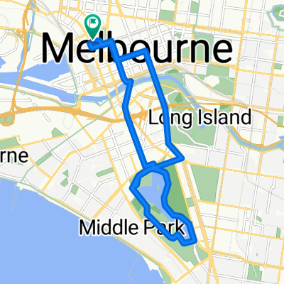
Capital City Trail
A cycling route starting in West Melbourne, Victoria, Australia.
Overview
About this route
- -:--
- Duration
- 29.3 km
- Distance
- 111 m
- Ascent
- 111 m
- Descent
- ---
- Avg. speed
- ---
- Max. altitude
Route quality
Waytypes & surfaces along the route
Waytypes
Cycleway
24.6 km
(84 %)
Pedestrian area
1.8 km
(6 %)
Surfaces
Paved
26.7 km
(91 %)
Unpaved
0.3 km
(1 %)
Asphalt
13.8 km
(47 %)
Concrete
9.7 km
(33 %)
Continue with Bikemap
Use, edit, or download this cycling route
You would like to ride Capital City Trail or customize it for your own trip? Here is what you can do with this Bikemap route:
Free features
- Save this route as favorite or in collections
- Copy & plan your own version of this route
- Sync your route with Garmin or Wahoo
Premium features
Free trial for 3 days, or one-time payment. More about Bikemap Premium.
- Navigate this route on iOS & Android
- Export a GPX / KML file of this route
- Create your custom printout (try it for free)
- Download this route for offline navigation
Discover more Premium features.
Get Bikemap PremiumFrom our community
Other popular routes starting in West Melbourne
 Slow ride in Melbourne
- Distance
- 32.3 km
- Ascent
- 395 m
- Descent
- 384 m
- Location
- West Melbourne, Victoria, Australia
 Home to FHS
- Distance
- 5.6 km
- Ascent
- 39 m
- Descent
- 38 m
- Location
- West Melbourne, Victoria, Australia
 Studley park hill
- Distance
- 24.1 km
- Ascent
- 658 m
- Descent
- 661 m
- Location
- West Melbourne, Victoria, Australia
 Rapha women Thursday ride
- Distance
- 17.3 km
- Ascent
- 285 m
- Descent
- 266 m
- Location
- West Melbourne, Victoria, Australia
 City to Flemington
- Distance
- 3 km
- Ascent
- 22 m
- Descent
- 40 m
- Location
- West Melbourne, Victoria, Australia
 West Melbourne to Moneponds
- Distance
- 12.1 km
- Ascent
- 38 m
- Descent
- 55 m
- Location
- West Melbourne, Victoria, Australia
 Albert Park
- Distance
- 31.7 km
- Ascent
- 70 m
- Descent
- 81 m
- Location
- West Melbourne, Victoria, Australia
 Anniversary Trail - Darebin Creek- Western Ring Road - Moonee Ponds Creek - Docklands - Yarra River- Gardiners Creek
- Distance
- 80.9 km
- Ascent
- 511 m
- Descent
- 508 m
- Location
- West Melbourne, Victoria, Australia
Open it in the app