
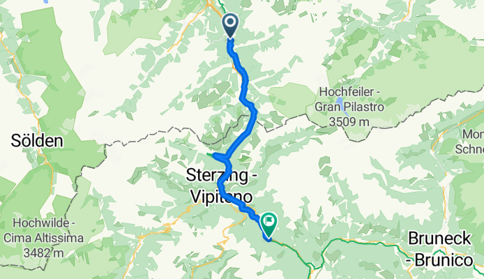
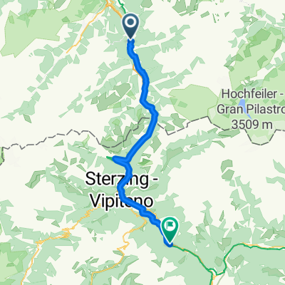
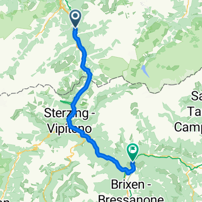
Von Matrei am Brenner bis Franzensfeste
A cycling route starting in Matrei am Brenner, Tyrol, Austria.
Overview
About this route
- 3 h 26 min
- Duration
- 52.2 km
- Distance
- 1,225 m
- Ascent
- 1,379 m
- Descent
- 15.2 km/h
- Avg. speed
- 1,389 m
- Max. altitude
Route quality
Waytypes & surfaces along the route
Waytypes
Cycleway
19.3 km
(37 %)
Quiet road
13.1 km
(25 %)
Surfaces
Paved
45.4 km
(87 %)
Unpaved
3.1 km
(6 %)
Asphalt
45.4 km
(87 %)
Gravel
2.1 km
(4 %)
Continue with Bikemap
Use, edit, or download this cycling route
You would like to ride Von Matrei am Brenner bis Franzensfeste or customize it for your own trip? Here is what you can do with this Bikemap route:
Free features
- Save this route as favorite or in collections
- Copy & plan your own version of this route
- Sync your route with Garmin or Wahoo
Premium features
Free trial for 3 days, or one-time payment. More about Bikemap Premium.
- Navigate this route on iOS & Android
- Export a GPX / KML file of this route
- Create your custom printout (try it for free)
- Download this route for offline navigation
Discover more Premium features.
Get Bikemap PremiumFrom our community
Other popular routes starting in Matrei am Brenner
 1987
1987- Distance
- 986.2 km
- Ascent
- 9,241 m
- Descent
- 10,048 m
- Location
- Matrei am Brenner, Tyrol, Austria
 Matrei am Brenner nach igls
- Distance
- 15.9 km
- Ascent
- 482 m
- Descent
- 605 m
- Location
- Matrei am Brenner, Tyrol, Austria
 Brenner Straße 46, Matrei am Brenner to Georg-Bucher-Straße 1, Axams
- Distance
- 34.6 km
- Ascent
- 2,520 m
- Descent
- 2,633 m
- Location
- Matrei am Brenner, Tyrol, Austria
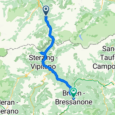 Gossensass - Fiè allo Sciliar
- Distance
- 70.5 km
- Ascent
- 1,553 m
- Descent
- 1,974 m
- Location
- Matrei am Brenner, Tyrol, Austria
 Stage1_Brennero_Uderns
- Distance
- 76.5 km
- Ascent
- 427 m
- Descent
- 872 m
- Location
- Matrei am Brenner, Tyrol, Austria
 Von Matrei am Brenner bis Franzensfeste
- Distance
- 52.2 km
- Ascent
- 1,225 m
- Descent
- 1,379 m
- Location
- Matrei am Brenner, Tyrol, Austria
 Tag 6 Matei am Brenner- Reutte
- Distance
- 112.6 km
- Ascent
- 2,170 m
- Descent
- 2,300 m
- Location
- Matrei am Brenner, Tyrol, Austria
 Route to Mühlbach
- Distance
- 64.5 km
- Ascent
- 1,686 m
- Descent
- 1,909 m
- Location
- Matrei am Brenner, Tyrol, Austria
Open it in the app