
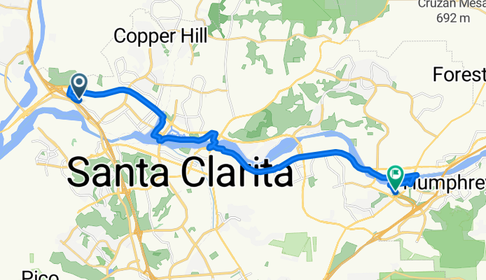
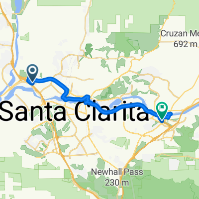
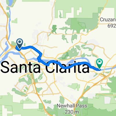
Technology Drive to Sierra Hwy & Via Princessa
A cycling route starting in Valencia, California, United States.
Overview
About this route
- < 1 min
- Duration
- 20.3 km
- Distance
- 228 m
- Ascent
- 67 m
- Descent
- 7,315.6 km/h
- Avg. speed
- 448 m
- Max. altitude

Route quality
Waytypes & surfaces along the route
Waytypes
Cycleway
13.8 km
(68 %)
Quiet road
2.6 km
(13 %)
Surfaces
Paved
15.2 km
(75 %)
Paved (undefined)
8.3 km
(41 %)
Asphalt
6.1 km
(30 %)
Continue with Bikemap
Use, edit, or download this cycling route
You would like to ride Technology Drive to Sierra Hwy & Via Princessa or customize it for your own trip? Here is what you can do with this Bikemap route:
Free features
- Save this route as favorite or in collections
- Copy & plan your own version of this route
- Sync your route with Garmin or Wahoo
Premium features
Free trial for 3 days, or one-time payment. More about Bikemap Premium.
- Navigate this route on iOS & Android
- Export a GPX / KML file of this route
- Create your custom printout (try it for free)
- Download this route for offline navigation
Discover more Premium features.
Get Bikemap PremiumFrom our community
Other popular routes starting in Valencia
 1st bbq of 2018
- Distance
- 14.2 km
- Ascent
- 130 m
- Descent
- 152 m
- Location
- Valencia, California, United States
 Technology Drive to Sierra Hwy & Via Princessa
- Distance
- 20.3 km
- Ascent
- 228 m
- Descent
- 67 m
- Location
- Valencia, California, United States
 Short bike tour from Santa Clarita to Rancho Santa Clarita
- Distance
- 7.1 km
- Ascent
- 60 m
- Descent
- 34 m
- Location
- Valencia, California, United States
 Santana
- Distance
- 20.2 km
- Ascent
- 153 m
- Descent
- 163 m
- Location
- Valencia, California, United States
 28164 Smyth Dr, Santa Clarita to 28140 Smyth Dr, Santa Clarita
- Distance
- 17 km
- Ascent
- 128 m
- Descent
- 130 m
- Location
- Valencia, California, United States
 Technology Drive to Sierra Hwy & Canyon Prk Blvd
- Distance
- 18.8 km
- Ascent
- 186 m
- Descent
- 27 m
- Location
- Valencia, California, United States
 Iron Horse Trail Course
- Distance
- 3.3 km
- Ascent
- 23 m
- Descent
- 5 m
- Location
- Valencia, California, United States
 commute home
- Distance
- 17.1 km
- Ascent
- 159 m
- Descent
- 54 m
- Location
- Valencia, California, United States
Open it in the app