
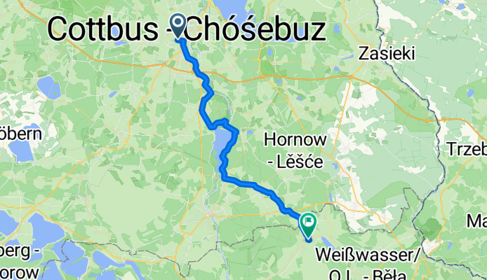
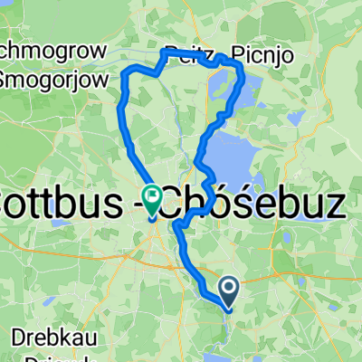
Cottbus Schleife
A cycling route starting in Cottbus, Brandenburg, Germany.
Overview
About this route
- 2 h 11 min
- Duration
- 37.8 km
- Distance
- 230 m
- Ascent
- 178 m
- Descent
- 17.3 km/h
- Avg. speed
- 159 m
- Max. altitude

Route quality
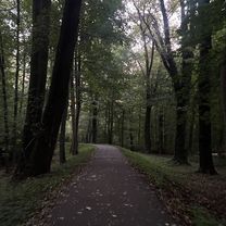
Waytypes & surfaces along the route
Waytypes
Path
13.2 km
(35 %)
Quiet road
11 km
(29 %)
Surfaces
Paved
30.6 km
(81 %)
Unpaved
2.6 km
(7 %)
Asphalt
30.6 km
(81 %)
Loose gravel
2.3 km
(6 %)
Continue with Bikemap
Use, edit, or download this cycling route
You would like to ride Cottbus Schleife or customize it for your own trip? Here is what you can do with this Bikemap route:
Free features
- Save this route as favorite or in collections
- Copy & plan your own version of this route
- Sync your route with Garmin or Wahoo
Premium features
Free trial for 3 days, or one-time payment. More about Bikemap Premium.
- Navigate this route on iOS & Android
- Export a GPX / KML file of this route
- Create your custom printout (try it for free)
- Download this route for offline navigation
Discover more Premium features.
Get Bikemap PremiumFrom our community
Other popular routes starting in Cottbus
 Vom-Stein-Straße, Cottbus nach Thiemstraße, Cottbus
- Distance
- 26.2 km
- Ascent
- 109 m
- Descent
- 107 m
- Location
- Cottbus, Brandenburg, Germany
 Cottbus Spreewald Burg Cottbus
- Distance
- 49 km
- Ascent
- 27 m
- Descent
- 37 m
- Location
- Cottbus, Brandenburg, Germany
 Spremberger Vorstadt, Cottbus nach Spremberger Vorstadt, Cottbus
- Distance
- 3.5 km
- Ascent
- 9 m
- Descent
- 9 m
- Location
- Cottbus, Brandenburg, Germany
 Schlachthofstraße, Cottbus nach Thiemstraße, Cottbus
- Distance
- 9.5 km
- Ascent
- 18 m
- Descent
- 9 m
- Location
- Cottbus, Brandenburg, Germany
 Route in Cottbus 11.10.2025
- Distance
- 49.2 km
- Ascent
- 112 m
- Descent
- 117 m
- Location
- Cottbus, Brandenburg, Germany
 Aufgezeichnet am 28. Sept. 2025, 16:52
- Distance
- 16.8 km
- Ascent
- 26 m
- Descent
- 34 m
- Location
- Cottbus, Brandenburg, Germany
 Cottbus Schleife
- Distance
- 37.8 km
- Ascent
- 230 m
- Descent
- 178 m
- Location
- Cottbus, Brandenburg, Germany
 BRT2013-MO: Durchs Strittmacherland - RTF der Spremberger Stahlwaden e.V. beim BRT2013 in Cottbus - 115 km Strecke
- Distance
- 130.8 km
- Ascent
- 343 m
- Descent
- 344 m
- Location
- Cottbus, Brandenburg, Germany
Open it in the app