

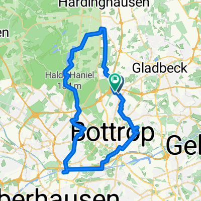
Bottrop nach Essener Straße
A cycling route starting in Bottrop, North Rhine-Westphalia, Germany.
Overview
About this route
- 27 min
- Duration
- 9.6 km
- Distance
- 55 m
- Ascent
- 103 m
- Descent
- 21.6 km/h
- Avg. speed
- 77 m
- Max. altitude

Route quality
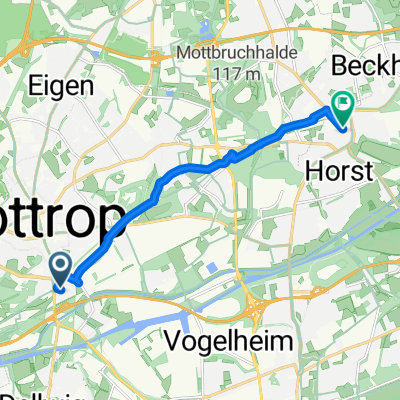
Waytypes & surfaces along the route
Waytypes
Path
4.5 km
(47 %)
Quiet road
3.3 km
(34 %)
Surfaces
Paved
4.6 km
(48 %)
Unpaved
3.5 km
(36 %)
Asphalt
4.4 km
(46 %)
Gravel
2.8 km
(29 %)
Continue with Bikemap
Use, edit, or download this cycling route
You would like to ride Bottrop nach Essener Straße or customize it for your own trip? Here is what you can do with this Bikemap route:
Free features
- Save this route as favorite or in collections
- Copy & plan your own version of this route
- Sync your route with Garmin or Wahoo
Premium features
Free trial for 3 days, or one-time payment. More about Bikemap Premium.
- Navigate this route on iOS & Android
- Export a GPX / KML file of this route
- Create your custom printout (try it for free)
- Download this route for offline navigation
Discover more Premium features.
Get Bikemap PremiumFrom our community
Other popular routes starting in Bottrop
 Bottrop-Wesel-Dinslaken-Bottrop
- Distance
- 77.4 km
- Ascent
- 196 m
- Descent
- 198 m
- Location
- Bottrop, North Rhine-Westphalia, Germany
 Bottroperwald Rundfahrt 30km mit Restaurant
- Distance
- 35.2 km
- Ascent
- 109 m
- Descent
- 108 m
- Location
- Bottrop, North Rhine-Westphalia, Germany
 AR6_23-BottropGrafenwald-OB-Sterkrade-Dinslaken-Kirchhellen_Heidesee-Grafenmühle
- Distance
- 22.8 km
- Ascent
- 75 m
- Descent
- 82 m
- Location
- Bottrop, North Rhine-Westphalia, Germany
 Halde Haniel - östlicher Aufgang
- Distance
- 3.1 km
- Ascent
- 142 m
- Descent
- 54 m
- Location
- Bottrop, North Rhine-Westphalia, Germany
 Route in Bottrop
- Distance
- 40.7 km
- Ascent
- 250 m
- Descent
- 248 m
- Location
- Bottrop, North Rhine-Westphalia, Germany
 Bottrop nach Essener Straße
- Distance
- 9.6 km
- Ascent
- 55 m
- Descent
- 103 m
- Location
- Bottrop, North Rhine-Westphalia, Germany
 Gesundheitspark große Runde über Oberhausen, Golfplatz zur Fahradfähre Dorsten und zurück.
- Distance
- 91.8 km
- Ascent
- 201 m
- Descent
- 201 m
- Location
- Bottrop, North Rhine-Westphalia, Germany
 Bottrop-Telgte-100km
- Distance
- 100.8 km
- Ascent
- 165 m
- Descent
- 147 m
- Location
- Bottrop, North Rhine-Westphalia, Germany
Open it in the app