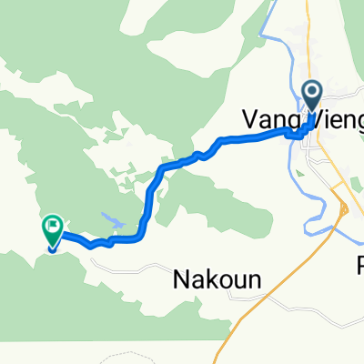
Route im Schneckentempo in Vang Vieng
- 21.5 km
- 264 m
- 323 m
- Vang Vieng, Vientiane Province, Laos
A cycling route starting in Vang Vieng, Vientiane Province, Laos.
Overview
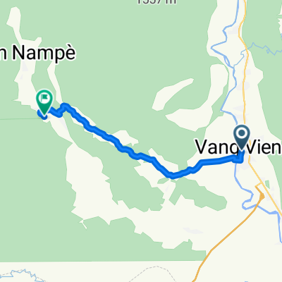
Embark on an exhilarating cycling adventure from the picturesque village of Vang Vieng to the stunning Blue Lagoon 3 in Vang Vieng. This scenic route stretches 16.2 kilometers, offering a perfect blend of gentle curves and undulating terrain.
As you pedal along, you'll traverse well-maintained asphalt roads that cover 85.4% of the route, providing a smooth and reliable surface for your ride. The Route tranquille designation ensures a peaceful and leisurely journey, making it ideal for both seasoned cyclists and those seeking a relaxing escape.
Throughout the ride, you'll experience a moderate ascent of 291 meters and a gentle descent of 200 meters, culminating in a maximum elevation of 349 meters. This elevation profile keeps the ride engaging and rewarding, offering stunning views at every turn.
The majority of the route is paved, covering 86.2% of the distance, ensuring stability and comfort. You'll also encounter a significant portion of the bike network, with 100% of the route being part of the non-defined bike network, allowing you to explore the area with ease and confidence.
Whether you're a local adventurer or a visitor seeking a unique experience, this cycling route from Vang Vieng to Blue Lagoon 3 promises an unforgettable journey through beautiful landscapes and serene surroundings.
AI generated
created this 2 months ago
Route quality
Quiet road
15.4 km
(95 %)
Road
0.6 km
(4 %)
Pedestrian area
0.2 km
(1 %)
Paved
13.9 km
(86 %)
Unpaved
1.1 km
(7 %)
Asphalt
13.8 km
(85 %)
Unpaved (undefined)
1 km
(6 %)
Continue with Bikemap
You would like to ride Vang Vieng à blue lagoon 3 or customize it for your own trip? Here is what you can do with this Bikemap route:
Free trial for 3 days, or one-time payment. More about Bikemap Premium.
Discover more Premium features.
Get Bikemap PremiumFrom our community
Open it in the app