
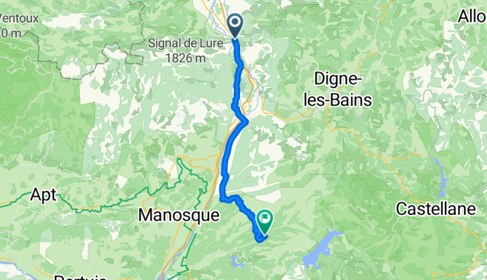
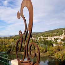
Sisteron to Allemagne-en-Provence
A cycling route starting in Sisteron, Provence-Alpes-Côte d'Azur Region, France.
Overview
About this route
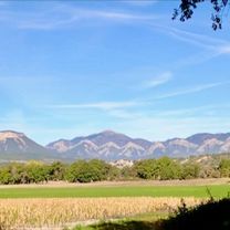
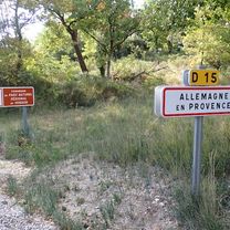
Overall, this was a really nice ride. D15 was particularly nice riding through some forests and some agricultural land.
- 24 h 11 min
- Duration
- 66.6 km
- Distance
- 897 m
- Ascent
- 942 m
- Descent
- 2.8 km/h
- Avg. speed
- 603 m
- Max. altitude

Route photos


Route quality
Waytypes & surfaces along the route
Waytypes
Road
25.3 km
(38 %)
Quiet road
2.7 km
(4 %)
Surfaces
Paved
53.9 km
(81 %)
Asphalt
53.9 km
(81 %)
Undefined
12.7 km
(19 %)
Continue with Bikemap
Use, edit, or download this cycling route
You would like to ride Sisteron to Allemagne-en-Provence or customize it for your own trip? Here is what you can do with this Bikemap route:
Free features
- Save this route as favorite or in collections
- Copy & plan your own version of this route
- Sync your route with Garmin or Wahoo
Premium features
Free trial for 3 days, or one-time payment. More about Bikemap Premium.
- Navigate this route on iOS & Android
- Export a GPX / KML file of this route
- Create your custom printout (try it for free)
- Download this route for offline navigation
Discover more Premium features.
Get Bikemap PremiumFrom our community
Other popular routes starting in Sisteron
 Sisteron - Circle to Claret
- Distance
- 54.3 km
- Ascent
- 798 m
- Descent
- 797 m
- Location
- Sisteron, Provence-Alpes-Côte d'Azur Region, France
 2012 French Tour -- Ride Day 39 -- 27 September 2012 -- Sisteron to Champtercier (via Dignes-les-Bains)
- Distance
- 74.4 km
- Ascent
- 1,107 m
- Descent
- 977 m
- Location
- Sisteron, Provence-Alpes-Côte d'Azur Region, France
 Alt1_From Sisteron to Allemagne-en-Provence
- Distance
- 80.1 km
- Ascent
- 1,683 m
- Descent
- 1,744 m
- Location
- Sisteron, Provence-Alpes-Côte d'Azur Region, France
 4. Tag Sisteron - Moustiers
- Distance
- 88.8 km
- Ascent
- 722 m
- Descent
- 613 m
- Location
- Sisteron, Provence-Alpes-Côte d'Azur Region, France
 Sorti du 1/09/2021 a Sisteron
- Distance
- 7.7 km
- Ascent
- 49 m
- Descent
- 60 m
- Location
- Sisteron, Provence-Alpes-Côte d'Azur Region, France
 Sisteron to Allemagne-en-Provence
- Distance
- 66.6 km
- Ascent
- 897 m
- Descent
- 942 m
- Location
- Sisteron, Provence-Alpes-Côte d'Azur Region, France
 Sisteron - Circle to Peipin
- Distance
- 14.8 km
- Ascent
- 145 m
- Descent
- 138 m
- Location
- Sisteron, Provence-Alpes-Côte d'Azur Region, France
 Durance - Buech - Eygues
- Distance
- 306.8 km
- Ascent
- 1,098 m
- Descent
- 1,111 m
- Location
- Sisteron, Provence-Alpes-Côte d'Azur Region, France
Open it in the app