
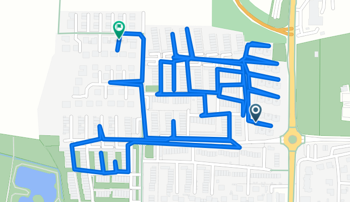
Embser Landstraße nach Sperlingsweg
A cycling route starting in Achim, Lower Saxony, Germany.
Overview
About this route
- 1 h 19 min
- Duration
- 4.7 km
- Distance
- 12 m
- Ascent
- 67 m
- Descent
- 3.5 km/h
- Avg. speed
- 68 m
- Max. altitude

Continue with Bikemap
Use, edit, or download this cycling route
You would like to ride Embser Landstraße nach Sperlingsweg or customize it for your own trip? Here is what you can do with this Bikemap route:
Free features
- Save this route as favorite or in collections
- Copy & plan your own version of this route
- Sync your route with Garmin or Wahoo
Premium features
Free trial for 3 days, or one-time payment. More about Bikemap Premium.
- Navigate this route on iOS & Android
- Export a GPX / KML file of this route
- Create your custom printout (try it for free)
- Download this route for offline navigation
Discover more Premium features.
Get Bikemap PremiumFrom our community
Other popular routes starting in Achim
 Uesener Feldstraße nach Hildesheimer Straße
- Distance
- 111.9 km
- Ascent
- 298 m
- Descent
- 270 m
- Location
- Achim, Lower Saxony, Germany
 Embser Landstraße nach Sperlingsweg
- Distance
- 4.7 km
- Ascent
- 12 m
- Descent
- 67 m
- Location
- Achim, Lower Saxony, Germany
 Fährstraße 11A, Thedinghausen nach Fährstraße, Thedinghausen
- Distance
- 37 km
- Ascent
- 500 m
- Descent
- 502 m
- Location
- Achim, Lower Saxony, Germany
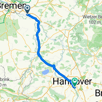
 Achim - Bremen Vegesack
- Distance
- 51 km
- Ascent
- 29 m
- Descent
- 48 m
- Location
- Achim, Lower Saxony, Germany
 Zeitungen
- Distance
- 6.6 km
- Ascent
- 59 m
- Descent
- 65 m
- Location
- Achim, Lower Saxony, Germany
 Achim - Syke - DEL
- Distance
- 54.5 km
- Ascent
- 136 m
- Descent
- 145 m
- Location
- Achim, Lower Saxony, Germany
 100er
100er- Distance
- 103.8 km
- Ascent
- 187 m
- Descent
- 199 m
- Location
- Achim, Lower Saxony, Germany
 Uesener Feldstraße nach Mackensenweg 8A
- Distance
- 63.4 km
- Ascent
- 108 m
- Descent
- 154 m
- Location
- Achim, Lower Saxony, Germany
Open it in the app