
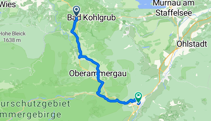
Bad Kohlgrub to Oberau
A cycling route starting in Saulgrub, Bavaria, Germany.
Overview
About this route
Start your cycling adventure in Saulgrub, Bavaria, Germany, and set off through the picturesque Oberammergau. This 23.8 km journey will take you to Oberau.
Climb steadily through varied terrain, with gentle ascents and descents, totaling 510 meters in elevation gain and 718 meters in descent. You'll encounter a mix of surfaces, including asphalt, gravel, and undefined paths, ensuring a dynamic ride.
Enjoy the quiet roads and tracks as you navigate the landscape, with a significant portion of your ride on the regional bike network.
This route offers a perfect blend of challenge and scenic beauty, making it an ideal choice for cyclists seeking an engaging ride through Bavaria.
AI generated
- 1 h 48 min
- Duration
- 23.8 km
- Distance
- 511 m
- Ascent
- 719 m
- Descent
- 13.2 km/h
- Avg. speed
- 919 m
- Max. altitude
Route quality
Waytypes & surfaces along the route
Waytypes
Quiet road
11.7 km
(49 %)
Track
9.3 km
(39 %)
Surfaces
Paved
13.1 km
(55 %)
Unpaved
6 km
(25 %)
Asphalt
13.1 km
(55 %)
Gravel
4.5 km
(19 %)
Continue with Bikemap
Use, edit, or download this cycling route
You would like to ride Bad Kohlgrub to Oberau or customize it for your own trip? Here is what you can do with this Bikemap route:
Free features
- Save this route as favorite or in collections
- Copy & plan your own version of this route
- Sync your route with Garmin or Wahoo
Premium features
Free trial for 3 days, or one-time payment. More about Bikemap Premium.
- Navigate this route on iOS & Android
- Export a GPX / KML file of this route
- Create your custom printout (try it for free)
- Download this route for offline navigation
Discover more Premium features.
Get Bikemap PremiumFrom our community
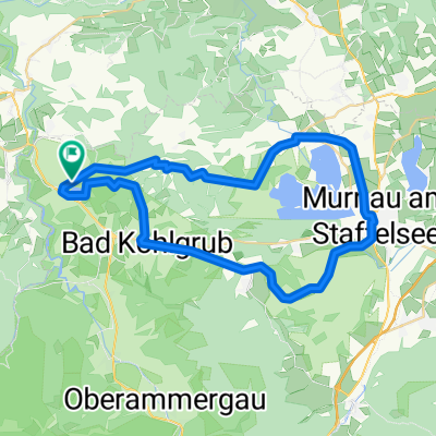
Other popular routes starting in Saulgrub
 Große Rundtour zum August Schuster Haus
- Distance
- 36.2 km
- Ascent
- 1,258 m
- Descent
- 1,258 m
- Location
- Saulgrub, Bavaria, Germany
 Tour 4
- Distance
- 14.6 km
- Ascent
- 327 m
- Descent
- 328 m
- Location
- Saulgrub, Bavaria, Germany
 Soienersee - Staffelsee
- Distance
- 39.8 km
- Ascent
- 447 m
- Descent
- 461 m
- Location
- Saulgrub, Bavaria, Germany
 Drei Schlösser
- Distance
- 105.5 km
- Ascent
- 1,320 m
- Descent
- 1,349 m
- Location
- Saulgrub, Bavaria, Germany
 Soinersee-Deutensee přes Wildsteig
- Distance
- 39.9 km
- Ascent
- 334 m
- Descent
- 336 m
- Location
- Saulgrub, Bavaria, Germany
 unternogg
- Distance
- 43.5 km
- Ascent
- 784 m
- Descent
- 578 m
- Location
- Saulgrub, Bavaria, Germany
 Soierensee-Staffelsee
- Distance
- 38.3 km
- Ascent
- 439 m
- Descent
- 442 m
- Location
- Saulgrub, Bavaria, Germany
 Land der Moore - Radeln zwischen Bayersoier See und Staffelsee
- Distance
- 44.9 km
- Ascent
- 374 m
- Descent
- 374 m
- Location
- Saulgrub, Bavaria, Germany
Open it in the app