
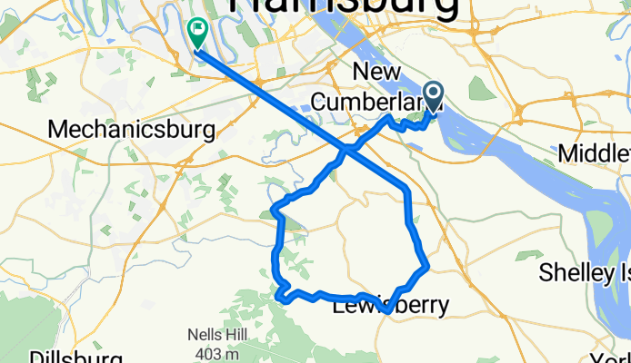
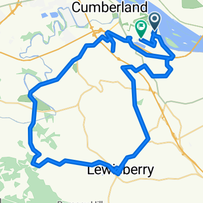
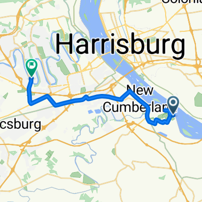
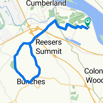
Mifflin Avenue to Pawnee Drive
A cycling route starting in Enhaut, Pennsylvania, United States.
Overview
About this route
- < 1 min
- Duration
- 40.7 km
- Distance
- 460 m
- Ascent
- 406 m
- Descent
- 10,454.1 km/h
- Avg. speed
- 238 m
- Max. altitude

Route quality
Waytypes & surfaces along the route
Waytypes
Quiet road
16.3 km
(40 %)
Road
13.8 km
(34 %)
Surfaces
Paved
7.7 km
(19 %)
Asphalt
7.7 km
(19 %)
Undefined
32.9 km
(81 %)
Continue with Bikemap
Use, edit, or download this cycling route
You would like to ride Mifflin Avenue to Pawnee Drive or customize it for your own trip? Here is what you can do with this Bikemap route:
Free features
- Save this route as favorite or in collections
- Copy & plan your own version of this route
- Sync your route with Garmin or Wahoo
Premium features
Free trial for 3 days, or one-time payment. More about Bikemap Premium.
- Navigate this route on iOS & Android
- Export a GPX / KML file of this route
- Create your custom printout (try it for free)
- Download this route for offline navigation
Discover more Premium features.
Get Bikemap PremiumFrom our community
Other popular routes starting in Enhaut
 F Avenue to F Avenue
- Distance
- 12 km
- Ascent
- 194 m
- Descent
- 160 m
- Location
- Enhaut, Pennsylvania, United States
 New Cumberlandfridididididiidid to New Cumberland
- Distance
- 49.7 km
- Ascent
- 778 m
- Descent
- 792 m
- Location
- Enhaut, Pennsylvania, United States
 F Avenue to F Avenue
- Distance
- 12.8 km
- Ascent
- 117 m
- Descent
- 87 m
- Location
- Enhaut, Pennsylvania, United States
 Mifflin Avenue to Pawnee Drive
- Distance
- 40.7 km
- Ascent
- 460 m
- Descent
- 406 m
- Location
- Enhaut, Pennsylvania, United States
 New Cumberland to New Cumberland
- Distance
- 14.3 km
- Ascent
- 223 m
- Descent
- 211 m
- Location
- Enhaut, Pennsylvania, United States
 Sporty route
- Distance
- 18.7 km
- Ascent
- 127 m
- Descent
- 68 m
- Location
- Enhaut, Pennsylvania, United States
 Bomb Diggity
- Distance
- 17 km
- Ascent
- 233 m
- Descent
- 236 m
- Location
- Enhaut, Pennsylvania, United States
 Relaxed route
- Distance
- 18.4 km
- Ascent
- 162 m
- Descent
- 130 m
- Location
- Enhaut, Pennsylvania, United States
Open it in the app