
Shijo-ohashi Bridge, 교토시에서 사쿄구, 교토시까지
A cycling route starting in Kyoto, Kyoto, Japan.
Overview
About this route
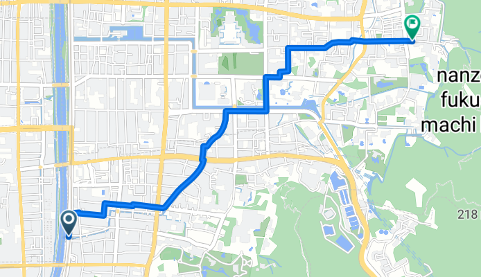
Begin your adventure at the Shijo-ohashi Bridge, where the city's energy meets the serenity of the path ahead. As you pedal, you'll glide over 967 meters of smooth asphalt, accounting for 28.7% of the journey. Here, the ride is mostly gentle, with just a few hills to keep things interesting.
As you continue, you'll encounter a mix of surfaces. A portion of 2290 meters will challenge your ride, with the terrain a bit more undefined. Despite this, the majority of your journey will be on paved roads, offering a comfortable and smooth ride.
The ride is an excellent way to experience Kyoto's quiet roads and scenic views. As you approach your destination, the elevation will rise, peaking at 66 meters. This final stretch will reward your effort with a beautiful view and a sense of accomplishment.
Arrive at Zenrin-ji, a hidden gem in Kyoto's left-behind district. Enjoy the peace and tranquility of this sacred space, a perfect end to your cycling adventure.
AI generated
- 13 min
- Duration
- 3.4 km
- Distance
- 23 m
- Ascent
- 0 m
- Descent
- 15.1 km/h
- Avg. speed
- 66 m
- Max. altitude
Route quality
Waytypes & surfaces along the route
Waytypes
Quiet road
2.2 km
(65 %)
Road
0.8 km
(25 %)
Surfaces
Paved
1.5 km
(45 %)
Unpaved
0 km
(1 %)
Asphalt
1.5 km
(45 %)
Ground
0 km
(1 %)
Undefined
1.8 km
(54 %)
Continue with Bikemap
Use, edit, or download this cycling route
You would like to ride Shijo-ohashi Bridge, 교토시에서 사쿄구, 교토시까지 or customize it for your own trip? Here is what you can do with this Bikemap route:
Free features
- Save this route as favorite or in collections
- Copy & plan your own version of this route
- Sync your route with Garmin or Wahoo
Premium features
Free trial for 3 days, or one-time payment. More about Bikemap Premium.
- Navigate this route on iOS & Android
- Export a GPX / KML file of this route
- Create your custom printout (try it for free)
- Download this route for offline navigation
Discover more Premium features.
Get Bikemap PremiumFrom our community
Other popular routes starting in Kyoto
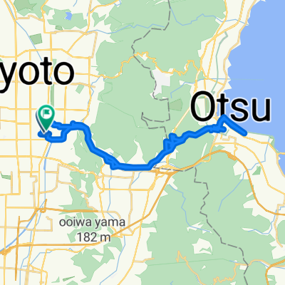
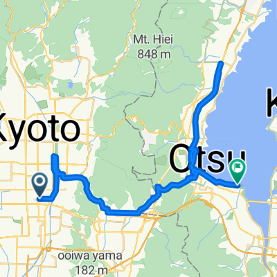
 Kyoto to Otsu
- Distance
- 30.5 km
- Ascent
- 899 m
- Descent
- 743 m
- Location
- Kyoto, Kyoto, Japan
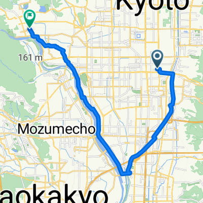
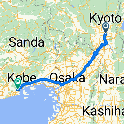
 Kyoto to otsu biwa lake to kyoto
- Distance
- 39.4 km
- Ascent
- 852 m
- Descent
- 877 m
- Location
- Kyoto, Kyoto, Japan
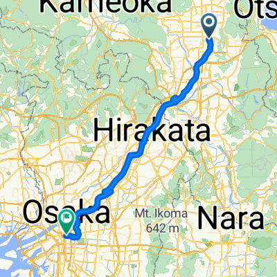
 Kyoto to Osaka
- Distance
- 56.3 km
- Ascent
- 241 m
- Descent
- 268 m
- Location
- Kyoto, Kyoto, Japan
 Takatsujicho, Kyoto to Ukyo, Kyoto
- Distance
- 19.5 km
- Ascent
- 105 m
- Descent
- 98 m
- Location
- Kyoto, Kyoto, Japan
 kyoto to osaka
- Distance
- 53.5 km
- Ascent
- 229 m
- Descent
- 242 m
- Location
- Kyoto, Kyoto, Japan
 Sasayacho, Kyoto to Sagatenryujisusukinobabacho, Kyoto
- Distance
- 9.8 km
- Ascent
- 25 m
- Descent
- 35 m
- Location
- Kyoto, Kyoto, Japan
 Kyoto to Otsu
- Distance
- 35.5 km
- Ascent
- 353 m
- Descent
- 311 m
- Location
- Kyoto, Kyoto, Japan
 Kyoto to 1-chōme
- Distance
- 94.3 km
- Ascent
- 648 m
- Descent
- 808 m
- Location
- Kyoto, Kyoto, Japan
Open it in the app