![Ph0]에서 경로충효동](/_next/static/media/contour-lines-light-small.cafd5e5d.avif)
![Ph0]에서 경로충효동](https://media.bikemap.net/routes/17681436/staticmaps/in_da30c71e-3df4-4b55-8acf-6f05feff69ab_694x400_bikemap-2021-3D-static.png)
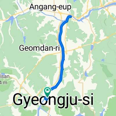
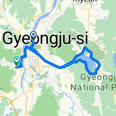
Ph0]에서 경로충효동
A cycling route starting in Gyeongju, Gyeongsangbuk-do, South Korea.
Overview
About this route
- 4 h 33 min
- Duration
- 62 km
- Distance
- 850 m
- Ascent
- 886 m
- Descent
- 13.6 km/h
- Avg. speed
- 575 m
- Max. altitude
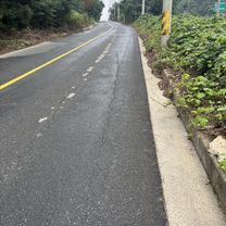
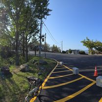
Route photos
![Photo 1 of the Bikemap route "Ph0]에서 경로충효동"](https://media.bikemap.net/routes/17681436/gallery/thumbs/7202d46d-dab1-4e62-b173-618103c0e371.jpg.688x400_q80_crop.jpg "Photo 1 of the Bikemap route \"Ph0]에서 경로충효동\"")
![Photo 2 of the Bikemap route "Ph0]에서 경로충효동"](https://media.bikemap.net/routes/17681436/gallery/thumbs/02d46cea-7ea5-4d38-b0f9-0a142b639a2f.jpg.688x400_q80_crop.jpg "Photo 2 of the Bikemap route \"Ph0]에서 경로충효동\"")
![Photo 3 of the Bikemap route "Ph0]에서 경로충효동"](https://media.bikemap.net/routes/17681436/gallery/thumbs/e00f821b-ef93-44e0-a06b-8c704146d410.jpg.208x208_q80_crop.jpg "Photo 3 of the Bikemap route \"Ph0]에서 경로충효동\"")
![Photo 4 of the Bikemap route "Ph0]에서 경로충효동"](https://media.bikemap.net/routes/17681436/gallery/thumbs/1fa68b0c-15a1-4a39-bc4b-b23448eb053a.jpg.208x208_q80_crop.jpg "Photo 4 of the Bikemap route \"Ph0]에서 경로충효동\"")
![Photo 5 of the Bikemap route "Ph0]에서 경로충효동"](https://media.bikemap.net/routes/17681436/gallery/thumbs/b260d4a9-7461-430b-bf1d-4c922d3eb0a9.jpg.208x208_q80_crop.jpg "Photo 5 of the Bikemap route \"Ph0]에서 경로충효동\"")
![Photo 6 of the Bikemap route "Ph0]에서 경로충효동"](https://media.bikemap.net/routes/17681436/gallery/thumbs/3cf21ded-0817-4a07-888f-39b61b5186c4.jpg.208x208_q80_crop.jpg "Photo 6 of the Bikemap route \"Ph0]에서 경로충효동\"")
![Photo 7 of the Bikemap route "Ph0]에서 경로충효동"](https://media.bikemap.net/routes/17681436/gallery/thumbs/8b26b1b2-705a-4dc8-b809-ec7905284228.jpg.208x208_q80_crop.jpg "Photo 7 of the Bikemap route \"Ph0]에서 경로충효동\"")
![Photo 8 of the Bikemap route "Ph0]에서 경로충효동"](https://media.bikemap.net/routes/17681436/gallery/thumbs/1ead1cc5-e6df-4934-93fb-565a8ae5be59.jpg.208x208_q80_crop.jpg "Photo 8 of the Bikemap route \"Ph0]에서 경로충효동\"")
Continue with Bikemap
Use, edit, or download this cycling route
You would like to ride Ph0]에서 경로충효동 or customize it for your own trip? Here is what you can do with this Bikemap route:
Free features
- Save this route as favorite or in collections
- Copy & plan your own version of this route
- Sync your route with Garmin or Wahoo
Premium features
Free trial for 3 days, or one-time payment. More about Bikemap Premium.
- Navigate this route on iOS & Android
- Export a GPX / KML file of this route
- Create your custom printout (try it for free)
- Download this route for offline navigation
Discover more Premium features.
Get Bikemap PremiumFrom our community
Other popular routes starting in Gyeongju
 20250617
- Distance
- 30 km
- Ascent
- 43 m
- Descent
- 86 m
- Location
- Gyeongju, Gyeongsangbuk-do, South Korea
![Ph0]에서 경로충효동 117-4](https://media.bikemap.net/routes/17519728/staticmaps/in_8151b71c-61ef-451f-aa6a-ab795a0b558f_400x400_bikemap-2021-3D-static.png) Ph0]에서 경로충효동 117-4
Ph0]에서 경로충효동 117-4- Distance
- 28.2 km
- Ascent
- 131 m
- Descent
- 161 m
- Location
- Gyeongju, Gyeongsangbuk-do, South Korea
 경주(낭산의 신비를 찾아서)
- Distance
- 14.4 km
- Ascent
- 128 m
- Descent
- 111 m
- Location
- Gyeongju, Gyeongsangbuk-do, South Korea
 경주 자전거코스
- Distance
- 32.4 km
- Ascent
- 932 m
- Descent
- 932 m
- Location
- Gyeongju, Gyeongsangbuk-do, South Korea
 초음속 경로
- Distance
- 34.4 km
- Ascent
- 192 m
- Descent
- 223 m
- Location
- Gyeongju, Gyeongsangbuk-do, South Korea
 성건동, 경주시에서 약성리, 포항시까지
- Distance
- 46.9 km
- Ascent
- 330 m
- Descent
- 369 m
- Location
- Gyeongju, Gyeongsangbuk-do, South Korea
![Ph0]에서 경로북군동 11-1](https://media.bikemap.net/routes/17321743/gallery/thumbs/16e4758b-722a-401a-b822-211a2e7d452b.jpg.208x208_q80_crop.jpg) Ph0]에서 경로북군동 11-1
Ph0]에서 경로북군동 11-1- Distance
- 729.6 km
- Ascent
- 26,913 m
- Descent
- 26,991 m
- Location
- Gyeongju, Gyeongsangbuk-do, South Korea
 편안한 경로
- Distance
- 45.3 km
- Ascent
- 371 m
- Descent
- 410 m
- Location
- Gyeongju, Gyeongsangbuk-do, South Korea
Open it in the app