

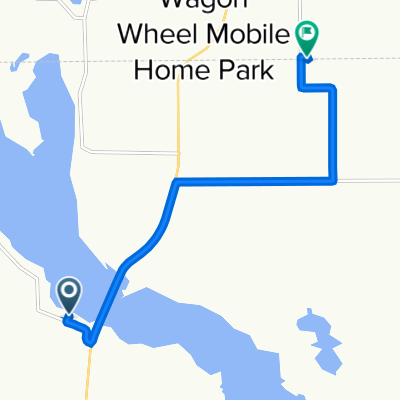
West Grand Rapids then north hwy 65
A cycling route starting in Grand Rapids, Minnesota, United States.
Overview
About this route
A lot of wild life on hwy 200 seen wolf right in front of me hwy 65 not best road has rumble strips on side so you have to ride in traffic lane
- -:--
- Duration
- 164.8 km
- Distance
- 207 m
- Ascent
- 196 m
- Descent
- ---
- Avg. speed
- ---
- Max. altitude
Route quality
Waytypes & surfaces along the route
Waytypes
Road
47.8 km
(29 %)
Cycleway
31.3 km
(19 %)
Surfaces
Paved
42.8 km
(26 %)
Unpaved
4.9 km
(3 %)
Asphalt
28 km
(17 %)
Paved (undefined)
14.8 km
(9 %)
Continue with Bikemap
Use, edit, or download this cycling route
You would like to ride West Grand Rapids then north hwy 65 or customize it for your own trip? Here is what you can do with this Bikemap route:
Free features
- Save this route as favorite or in collections
- Copy & plan your own version of this route
- Split it into stages to create a multi-day tour
- Sync your route with Garmin or Wahoo
Premium features
Free trial for 3 days, or one-time payment. More about Bikemap Premium.
- Navigate this route on iOS & Android
- Export a GPX / KML file of this route
- Create your custom printout (try it for free)
- Download this route for offline navigation
Discover more Premium features.
Get Bikemap PremiumFrom our community
Other popular routes starting in Grand Rapids
 Airport Road 21998, Grand Rapids to Crystal Springs Road 33170, Grand Rapids
- Distance
- 21.7 km
- Ascent
- 74 m
- Descent
- 90 m
- Location
- Grand Rapids, Minnesota, United States
 Blackberry coleraine
- Distance
- 45.9 km
- Ascent
- 172 m
- Descent
- 161 m
- Location
- Grand Rapids, Minnesota, United States
 Crystal Springs Road 33136, Grand Rapids to Crystal Springs Road 33136, Grand Rapids
- Distance
- 60.6 km
- Ascent
- 276 m
- Descent
- 271 m
- Location
- Grand Rapids, Minnesota, United States
 U.S. Route 2 680, Grand Rapids to Mesabi Trail, Eveleth
- Distance
- 125.1 km
- Ascent
- 967 m
- Descent
- 874 m
- Location
- Grand Rapids, Minnesota, United States
 Great River Energy Mesabi Trail Ride
- Distance
- 114.4 km
- Ascent
- 280 m
- Descent
- 236 m
- Location
- Grand Rapids, Minnesota, United States
 Crystal Springs Road 33170, Grand Rapids to Airport Road 21998, Grand Rapids
- Distance
- 7.2 km
- Ascent
- 42 m
- Descent
- 16 m
- Location
- Grand Rapids, Minnesota, United States
 After work ride
- Distance
- 66.4 km
- Ascent
- 171 m
- Descent
- 171 m
- Location
- Grand Rapids, Minnesota, United States
 After work ride
- Distance
- 45.8 km
- Ascent
- 178 m
- Descent
- 176 m
- Location
- Grand Rapids, Minnesota, United States
Open it in the app