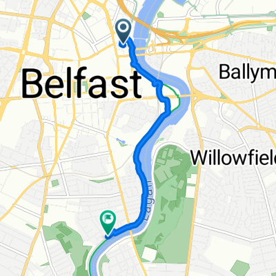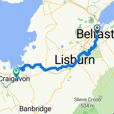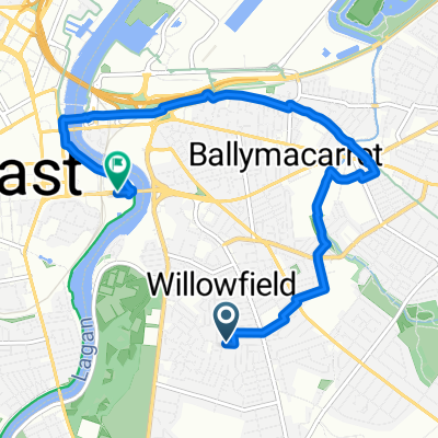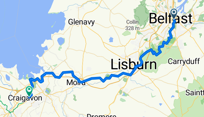

Route in Belfast
- 4 km
- 6 m
- 7 m
- Belfast, Northern Ireland, United Kingdom
A cycling route starting in Belfast, Northern Ireland, United Kingdom.
Overview
DEVELOPED - DEVELOPED - DEVELOPED_WITH_SIGNS - DEVELOPED - DEVELOPED_WITH_SIGNS - DEVELOPED_WITH_SIGNS - DEVELOPED_WITH_SIGNS - DEVELOPED_WITH_SIGNS - DEVELOPED_WITH_SIGNS - DEVELOPED_WITH_SIGNS - DEVELOPED_WITH_SIGNS - DEVELOPED_WITH_SIGNS - DEVELOPED_WITH_SIGNS - DEVELOPED_WITH_SIGNS - DEVELOPED_WITH_SIGNS - DEVELOPED_WITH_SIGNS - DEVELOPED_WITH_SIGNS - DEVELOPED_WITH_SIGNS - DEVELOPED_WITH_SIGNS - DEVELOPED_WITH_SIGNS - DEVELOPED_WITH_SIGNS - DEVELOPED_WITH_SIGNS - DEVELOPED_WITH_SIGNS - DEVELOPED_WITH_SIGNS - DEVELOPED_WITH_SIGNS - DEVELOPED_WITH_SIGNS - DEVELOPED_WITH_SIGNS - DEVELOPED_WITH_SIGNS - DEVELOPED_WITH_SIGNS - DEVELOPED_WITH_SIGNS - DEVELOPED_WITH_SIGNS - DEVELOPED_WITH_SIGNS - DEVELOPED_WITH_SIGNS - DEVELOPED_WITH_SIGNS - DEVELOPED_WITH_SIGNS - DEVELOPED_WITH_SIGNS - DEVELOPED_WITH_SIGNS - DEVELOPED_WITH_SIGNS - DEVELOPED_WITH_SIGNS - DEVELOPED_WITH_SIGNS - DEVELOPED_WITH_SIGNS - DEVELOPED_WITH_SIGNS - DEVELOPED_WITH_SIGNS - DEVELOPED_WITH_SIGNS - DEVELOPED_WITH_SIGNS - DEVELOPED_WITH_SIGNS - DEVELOPED_WITH_SIGNS - DEVELOPED_WITH_SIGNS - DEVELOPED_WITH_SIGNS
created this 2 months ago
Continue with Bikemap
You would like to ride 01: Belfast – Craigavon (DEVELOPED) - 02: Craigavon – Cookstown (DEVELOPED) - 03: Cookstown – Lifford (DEVELOPED_WITH_SIGNS) - 04: Lifford – Bridgend (DEVELO... or customize it for your own trip? Here is what you can do with this Bikemap route:
Free trial for 3 days, or one-time payment. More about Bikemap Premium.
Discover more Premium features.
Get Bikemap PremiumFrom our community
Open it in the app