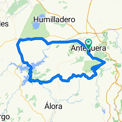
Day 4 Antequera Hills - Parador de Ronda (traced)
A cycling route starting in Antequera, Andalusia, Spain.
Overview
About this route
- 5 h 18 min
- Duration
- 90.2 km
- Distance
- 2,185 m
- Ascent
- 1,961 m
- Descent
- 17 km/h
- Avg. speed
- 1,072 m
- Max. altitude
Route quality
Waytypes & surfaces along the route
Waytypes
Road
29.8 km
(33 %)
Quiet road
16.2 km
(18 %)
Surfaces
Paved
42.4 km
(47 %)
Asphalt
31.6 km
(35 %)
Paved (undefined)
9.9 km
(11 %)
Continue with Bikemap
Use, edit, or download this cycling route
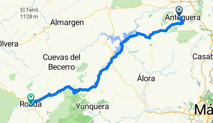
You would like to ride Day 4 Antequera Hills - Parador de Ronda (traced) or customize it for your own trip? Here is what you can do with this Bikemap route:
Free features
- Save this route as favorite or in collections
- Copy & plan your own version of this route
- Split it into stages to create a multi-day tour
- Sync your route with Garmin or Wahoo
Premium features
Free trial for 3 days, or one-time payment. More about Bikemap Premium.
- Navigate this route on iOS & Android
- Export a GPX / KML file of this route
- Create your custom printout (try it for free)
- Download this route for offline navigation
Discover more Premium features.
Get Bikemap PremiumFrom our community
Other popular routes starting in Antequera
9ª R.N.9 km Eta Antequera - Valdepeñas de Jaén 163,7km- Distance
- 172.4 km
- Ascent
- 1,893 m
- Descent
- 1,424 m
- Location
- Antequera, Andalusia, Spain
de Parquesol por los 8 puentes al torcal- Distance
- 29.5 km
- Ascent
- 1,150 m
- Descent
- 437 m
- Location
- Antequera, Andalusia, Spain
Antequera, El Chorro, Vva. Concepción, Torcal, Antequera- Distance
- 108.7 km
- Ascent
- 1,635 m
- Descent
- 1,610 m
- Location
- Antequera, Andalusia, Spain
Antequera - Subida al Torcal - Antequera - Mollina - Humilladero - Fuente de Piedra - Sierra de Yeguas- Distance
- 76.2 km
- Ascent
- 1,080 m
- Descent
- 1,118 m
- Location
- Antequera, Andalusia, Spain
DESAFIO TORCAL- Distance
- 42.6 km
- Ascent
- 1,091 m
- Descent
- 1,088 m
- Location
- Antequera, Andalusia, Spain
Antequera - Arroyo adelfas - Nacimiento - Antequera- Distance
- 18.4 km
- Ascent
- 360 m
- Descent
- 360 m
- Location
- Antequera, Andalusia, Spain
Vuelta El Chorro desde Antequera- Distance
- 111.8 km
- Ascent
- 1,269 m
- Descent
- 1,257 m
- Location
- Antequera, Andalusia, Spain
Antequera to El Chorro- Distance
- 30 km
- Ascent
- 758 m
- Descent
- 1,055 m
- Location
- Antequera, Andalusia, Spain
Open it in the app

