

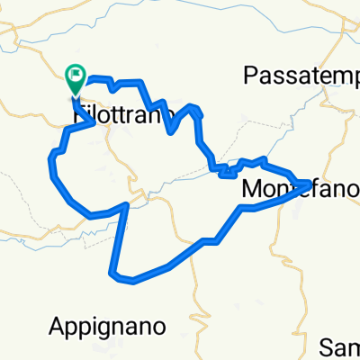
GARA MTB FILOTTRANO
A cycling route starting in Filottrano, The Marches, Italy.
Overview
About this route
<span style="font-family: Verdana; font-size: x-small;">Il percorso, metà sterrato e metà asfaltato, si snoda per due giri tra campagna e strade cittadine di Filottrano. <br />Richiede concentrazione, prontezza di riflessi e qualità tecniche. <br /> L’arrivo è nella centralissima Piazza Mazzini.</span>
- -:--
- Duration
- 15.5 km
- Distance
- 502 m
- Ascent
- 501 m
- Descent
- ---
- Avg. speed
- ---
- Max. altitude

Continue with Bikemap
Use, edit, or download this cycling route
You would like to ride GARA MTB FILOTTRANO or customize it for your own trip? Here is what you can do with this Bikemap route:
Free features
- Save this route as favorite or in collections
- Copy & plan your own version of this route
- Sync your route with Garmin or Wahoo
Premium features
Free trial for 3 days, or one-time payment. More about Bikemap Premium.
- Navigate this route on iOS & Android
- Export a GPX / KML file of this route
- Create your custom printout (try it for free)
- Download this route for offline navigation
Discover more Premium features.
Get Bikemap PremiumFrom our community
Other popular routes starting in Filottrano
 FILOTTRANO - ANELLO DIGA DI CINGOLI
- Distance
- 58.7 km
- Ascent
- 679 m
- Descent
- 678 m
- Location
- Filottrano, The Marches, Italy
 GARA MTB FILOTTRANO
- Distance
- 15.5 km
- Ascent
- 502 m
- Descent
- 501 m
- Location
- Filottrano, The Marches, Italy
 Filottrano - Roccaccia S.Lorenzo di Treia e ritorno
- Distance
- 50.8 km
- Ascent
- 1,215 m
- Descent
- 1,239 m
- Location
- Filottrano, The Marches, Italy
 Anello
- Distance
- 64.2 km
- Ascent
- 829 m
- Descent
- 842 m
- Location
- Filottrano, The Marches, Italy
 Filottrano SanVicino da Matelica
- Distance
- 117 km
- Ascent
- 1,752 m
- Descent
- 1,746 m
- Location
- Filottrano, The Marches, Italy
 ALLENAMENTO MTB con sterrato selva Montoro
- Distance
- 35.5 km
- Ascent
- 273 m
- Descent
- 273 m
- Location
- Filottrano, The Marches, Italy
 Recovered Route 21-mar
- Distance
- 49.8 km
- Ascent
- 752 m
- Descent
- 754 m
- Location
- Filottrano, The Marches, Italy
 Filottrano Colline MTB
- Distance
- 31 km
- Ascent
- 451 m
- Descent
- 451 m
- Location
- Filottrano, The Marches, Italy
Open it in the app