
Unterseen - Aarberg + Aarberg - Olten + Olten - Stein
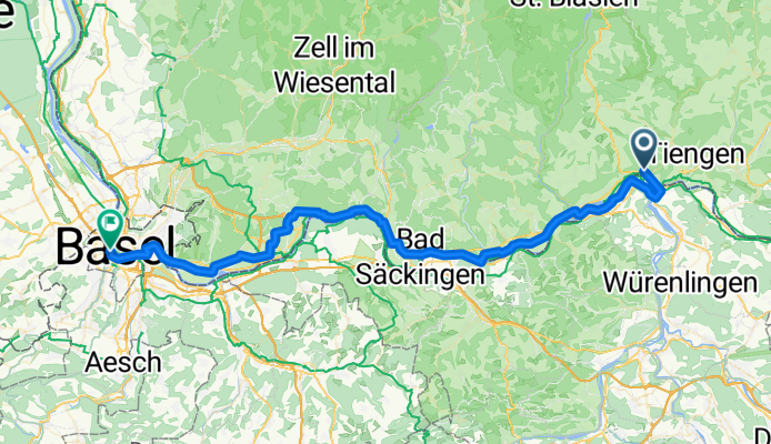
Lauffohr (Brugg) - Basel
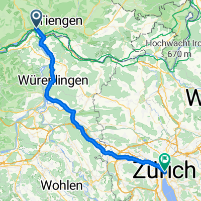
A cycling route starting in Waldshut-Tiengen, Baden-Wurttemberg, Germany.
Overview
About this route
- 4 h
- Duration
- 68.9 km
- Distance
- 389 m
- Ascent
- 462 m
- Descent
- 17.2 km/h
- Avg. speed
- 363 m
- Max. altitude
Part of
Route quality
Waytypes & surfaces along the route
Waytypes
Quiet road
30.3 km
(44 %)
Path
15.1 km
(22 %)
Surfaces
Paved
59.9 km
(87 %)
Unpaved
5.5 km
(8 %)
Asphalt
57.8 km
(84 %)
Gravel
5.5 km
(8 %)
Continue with Bikemap
Use, edit, or download this cycling route
You would like to ride Lauffohr (Brugg) - Basel or customize it for your own trip? Here is what you can do with this Bikemap route:
Free features
- Save this route as favorite or in collections
- Copy & plan your own version of this route
- Sync your route with Garmin or Wahoo
Premium features
Free trial for 3 days, or one-time payment. More about Bikemap Premium.
- Navigate this route on iOS & Android
- Export a GPX / KML file of this route
- Create your custom printout (try it for free)
- Download this route for offline navigation
Discover more Premium features.
Get Bikemap PremiumFrom our community
Other popular routes starting in Waldshut-Tiengen
 Krankenhaus - Aarberg
- Distance
- 3.1 km
- Ascent
- 108 m
- Descent
- 3 m
- Location
- Waldshut-Tiengen, Baden-Wurttemberg, Germany
 Von Waldshut-Tiengen bis Rheinfelden (Baden)
- Distance
- 45.5 km
- Ascent
- 257 m
- Descent
- 322 m
- Location
- Waldshut-Tiengen, Baden-Wurttemberg, Germany
 SS-RW 2.E Tiengen - Obereichsel (Rheinfelden)
- Distance
- 60 km
- Ascent
- 429 m
- Descent
- 329 m
- Location
- Waldshut-Tiengen, Baden-Wurttemberg, Germany
 trainingsrunde
- Distance
- 30.3 km
- Ascent
- 497 m
- Descent
- 494 m
- Location
- Waldshut-Tiengen, Baden-Wurttemberg, Germany
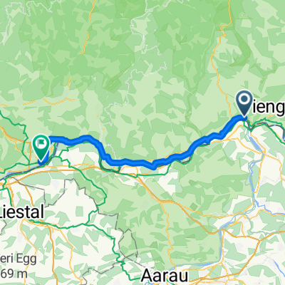
 Tiengen - Hugstetten (Wiesental)
- Distance
- 125.6 km
- Ascent
- 837 m
- Descent
- 1,021 m
- Location
- Waldshut-Tiengen, Baden-Wurttemberg, Germany
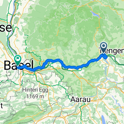 Lauffohr (Brugg) - Basel
- Distance
- 68.9 km
- Ascent
- 389 m
- Descent
- 462 m
- Location
- Waldshut-Tiengen, Baden-Wurttemberg, Germany
 Waldshut nach Nussbaumen
- Distance
- 21.1 km
- Ascent
- 145 m
- Descent
- 84 m
- Location
- Waldshut-Tiengen, Baden-Wurttemberg, Germany
 Lauffohr (Brugg) - Zürich (Kreis 1) / Lindenhof
- Distance
- 49.4 km
- Ascent
- 369 m
- Descent
- 297 m
- Location
- Waldshut-Tiengen, Baden-Wurttemberg, Germany
Open it in the app