
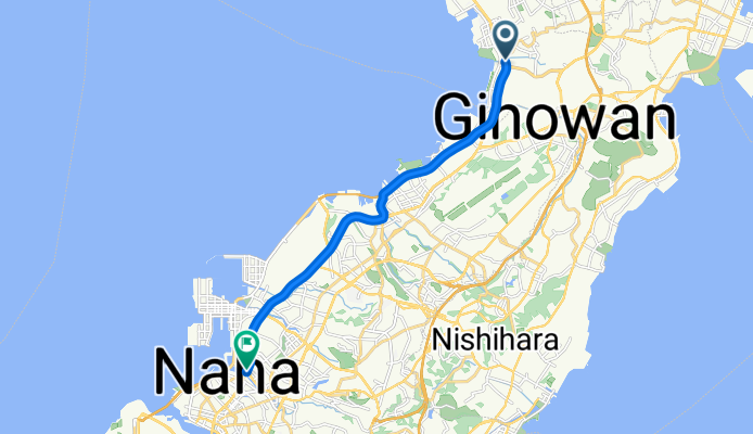
Overview
About this route
- 51 min
- Duration
- 13.8 km
- Distance
- 45 m
- Ascent
- 46 m
- Descent
- 16.2 km/h
- Avg. speed
- 29 m
- Max. altitude

Part of
本島一周コース
6 stages
Continue with Bikemap
Use, edit, or download this cycling route
You would like to ride Chatan - Naha or customize it for your own trip? Here is what you can do with this Bikemap route:
Free features
- Save this route as favorite or in collections
- Copy & plan your own version of this route
- Sync your route with Garmin or Wahoo
Premium features
Free trial for 3 days, or one-time payment. More about Bikemap Premium.
- Navigate this route on iOS & Android
- Export a GPX / KML file of this route
- Create your custom printout (try it for free)
- Download this route for offline navigation
Discover more Premium features.
Get Bikemap PremiumFrom our community
Other popular routes starting in Chatan
 北谷~残波岬
- Distance
- 37.8 km
- Ascent
- 200 m
- Descent
- 200 m
- Location
- Chatan, Okinawa, Japan
 456-2, Chatan to 761-2, Yomitan
- Distance
- 7.4 km
- Ascent
- 64 m
- Descent
- 99 m
- Location
- Chatan, Okinawa, Japan
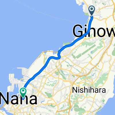 Chatan - Naha
- Distance
- 13.8 km
- Ascent
- 45 m
- Descent
- 46 m
- Location
- Chatan, Okinawa, Japan
 Hamagawa, Chatan-Cho, Nakagami-Gun to 523, Sobe, Yomitan-Son, Nakagami-Gun
- Distance
- 7.6 km
- Ascent
- 30 m
- Descent
- 46 m
- Location
- Chatan, Okinawa, Japan
 Zukeran, Kitanakagusuku, Nakagami-Gun to 1068, Kitamae, Chatan, Nakagami-Gun
- Distance
- 11.1 km
- Ascent
- 78 m
- Descent
- 73 m
- Location
- Chatan, Okinawa, Japan
 840-3, Chatan to 840-3, Chatan
- Distance
- 17.3 km
- Ascent
- 120 m
- Descent
- 123 m
- Location
- Chatan, Okinawa, Japan
 Naha - Chatan
- Distance
- 19.8 km
- Ascent
- 132 m
- Descent
- 123 m
- Location
- Chatan, Okinawa, Japan
 424-1, Chunjun, Kitanakagusuku, Nakagami-Gun to Yafuso, Urasoe
- Distance
- 13 km
- Ascent
- 79 m
- Descent
- 148 m
- Location
- Chatan, Okinawa, Japan
Open it in the app