
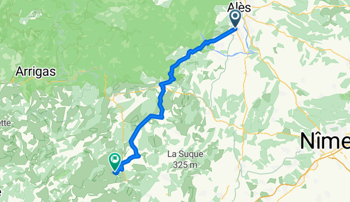
St-Christol-Lez-Alès to St-Martin-de-Londres
A cycling route starting in Saint-Christol-les-Alès, Occitanie, France.
Overview
About this route
With the exception of the time on D910A getting to Anduze, pretty much all of this ride was on zero and low-traffic roads. Really nice.
- 48 h 51 min
- Duration
- 67.7 km
- Distance
- 1,425 m
- Ascent
- 1,290 m
- Descent
- 1.4 km/h
- Avg. speed
- 338 m
- Max. altitude

Route photos


Route quality
Waytypes & surfaces along the route
Waytypes
Road
42 km
(62 %)
Quiet road
2.7 km
(4 %)
Surfaces
Paved
33.8 km
(50 %)
Asphalt
33.8 km
(50 %)
Undefined
33.8 km
(50 %)
Continue with Bikemap
Use, edit, or download this cycling route
You would like to ride St-Christol-Lez-Alès to St-Martin-de-Londres or customize it for your own trip? Here is what you can do with this Bikemap route:
Free features
- Save this route as favorite or in collections
- Copy & plan your own version of this route
- Sync your route with Garmin or Wahoo
Premium features
Free trial for 3 days, or one-time payment. More about Bikemap Premium.
- Navigate this route on iOS & Android
- Export a GPX / KML file of this route
- Create your custom printout (try it for free)
- Download this route for offline navigation
Discover more Premium features.
Get Bikemap PremiumFrom our community
Other popular routes starting in Saint-Christol-les-Alès
 De Chemin des Brusques 6520, Saint-Christol-lès-Alès à Route des Saintes Maries de la Mer, Arles
- Distance
- 21.3 km
- Ascent
- 69 m
- Descent
- 114 m
- Location
- Saint-Christol-les-Alès, Occitanie, France
 h.g.g.jglkg.
- Distance
- 179.1 km
- Ascent
- 3,272 m
- Descent
- 1,871 m
- Location
- Saint-Christol-les-Alès, Occitanie, France
 559 Chemin du Mas Cauvy, Saint-Christol-lès-Alès à Route de Canaules, Saint-Jean-de-Crieulon
- Distance
- 22.8 km
- Ascent
- 151 m
- Descent
- 144 m
- Location
- Saint-Christol-les-Alès, Occitanie, France
 De 129 Chemin du Cabot, Saint-Christol-lès-Alès à 13 Avenue Carnot, Alès
- Distance
- 6.2 km
- Ascent
- 69 m
- Descent
- 78 m
- Location
- Saint-Christol-les-Alès, Occitanie, France
 Chemin du Mas Cauvy 559, Saint-Christol-lès-Alès naar Rue du Pailleras 19, Saint-Hilaire-de-Brethmas
- Distance
- 12.1 km
- Ascent
- 77 m
- Descent
- 72 m
- Location
- Saint-Christol-les-Alès, Occitanie, France
 St Guilhem le Désert 2
- Distance
- 173.5 km
- Ascent
- 1,383 m
- Descent
- 1,383 m
- Location
- Saint-Christol-les-Alès, Occitanie, France
 St Guilhem le Désert 1
- Distance
- 189.7 km
- Ascent
- 1,622 m
- Descent
- 1,623 m
- Location
- Saint-Christol-les-Alès, Occitanie, France
 370 Chemin de Francezon, Alès à 1230 Chemin des Dupines, Alès
- Distance
- 9.2 km
- Ascent
- 65 m
- Descent
- 64 m
- Location
- Saint-Christol-les-Alès, Occitanie, France
Open it in the app