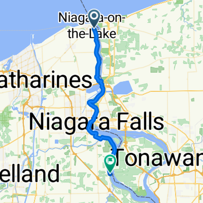


67–99 Market St, St. Catharines to 4310 Queen St, Niagara Falls
- 21.4 km
- 122 m
- 57 m
- St. Catharines, Ontario, Canada
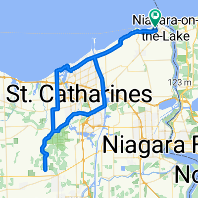
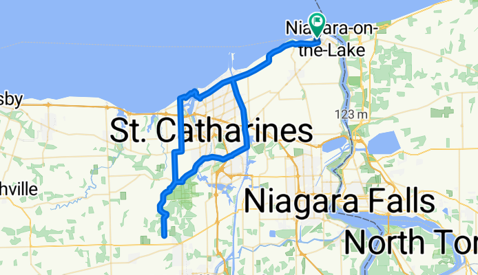
A cycling route starting in St. Catharines, Ontario, Canada.
Overview
Embark on a thrilling cycling adventure along this scenic route, perfect for those seeking a mix of challenge and beauty. Starting your journey at an elevation of 252 meters, you'll gradually ascend through a variety of terrains, culminating in a maximum elevation of 252 meters. The route boasts an elevation gain of 313 meters and a corresponding descent of the same, ensuring a balanced ride. The total distance is 76.3 kilometers, offering ample time to soak in the surrounding landscapes. As you pedal, enjoy the diverse surface types that add an exciting twist to your ride. Whether you're navigating paved paths or exploring unpaved trails, this route caters to both seasoned cyclists and enthusiastic beginners alike. Prepare for a rewarding experience that combines physical challenge with breathtaking views.
AI generated
created this 1 month ago
Route quality
Road
16.8 km
(22 %)
Quiet road
9.2 km
(12 %)
Paved
72.5 km
(95 %)
Asphalt
65.6 km
(86 %)
Paved (undefined)
5.3 km
(7 %)
Continue with Bikemap
You would like to ride Navihood or customize it for your own trip? Here is what you can do with this Bikemap route:
Free trial for 3 days, or one-time payment. More about Bikemap Premium.
Discover more Premium features.
Get Bikemap PremiumFrom our community
Open it in the app