
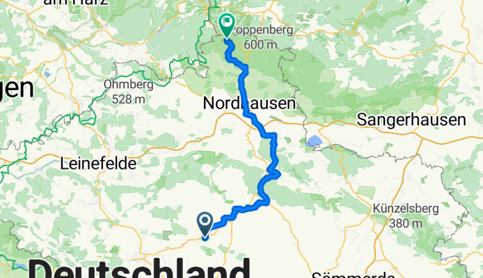
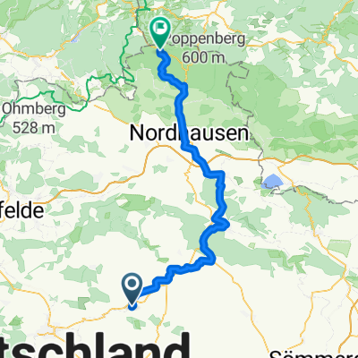
Hexenbesen
A cycling route starting in Schlotheim, Thuringia, Germany.
Overview
About this route
- 4 h 35 min
- Duration
- 71.9 km
- Distance
- 899 m
- Ascent
- 567 m
- Descent
- 15.7 km/h
- Avg. speed
- 595 m
- Max. altitude
Route quality
Waytypes & surfaces along the route
Waytypes
Track
18.7 km
(26 %)
Path
15.8 km
(22 %)
Surfaces
Paved
40.3 km
(56 %)
Unpaved
16.5 km
(23 %)
Asphalt
38.8 km
(54 %)
Gravel
12.9 km
(18 %)
Continue with Bikemap
Use, edit, or download this cycling route
You would like to ride Hexenbesen or customize it for your own trip? Here is what you can do with this Bikemap route:
Free features
- Save this route as favorite or in collections
- Copy & plan your own version of this route
- Sync your route with Garmin or Wahoo
Premium features
Free trial for 3 days, or one-time payment. More about Bikemap Premium.
- Navigate this route on iOS & Android
- Export a GPX / KML file of this route
- Create your custom printout (try it for free)
- Download this route for offline navigation
Discover more Premium features.
Get Bikemap PremiumFrom our community
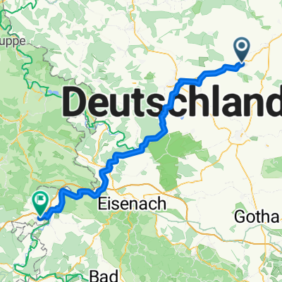
Other popular routes starting in Schlotheim
 Ruhige Route
- Distance
- 78.9 km
- Ascent
- 427 m
- Descent
- 507 m
- Location
- Schlotheim, Thuringia, Germany
 Sondershausen Bad Frankenhausen
- Distance
- 78.7 km
- Ascent
- 732 m
- Descent
- 707 m
- Location
- Schlotheim, Thuringia, Germany
 Hexenbesen
- Distance
- 71.9 km
- Ascent
- 899 m
- Descent
- 567 m
- Location
- Schlotheim, Thuringia, Germany
 Schnelle Ausfahrt vom 8. August 17:33
- Distance
- 7.4 km
- Ascent
- 44 m
- Descent
- 43 m
- Location
- Schlotheim, Thuringia, Germany
 schlotheim HIG SOODEN
- Distance
- 79.2 km
- Ascent
- 894 m
- Descent
- 915 m
- Location
- Schlotheim, Thuringia, Germany
 Steinweg 38, Nottertal-Heilinger Höhen nach Bergstraße 4, Nottertal-Heilinger Höhen
- Distance
- 38.5 km
- Ascent
- 461 m
- Descent
- 506 m
- Location
- Schlotheim, Thuringia, Germany
 Weststraße 21, Nottertal-Heilinger Höhen nach Weststraße 23, Nottertal-Heilinger Höhen
- Distance
- 68.4 km
- Ascent
- 468 m
- Descent
- 466 m
- Location
- Schlotheim, Thuringia, Germany
 Weststraße 21, Nottertal-Heilinger Höhen nach Hauptstraße 26, Marolterode
- Distance
- 30.9 km
- Ascent
- 420 m
- Descent
- 380 m
- Location
- Schlotheim, Thuringia, Germany
Open it in the app