
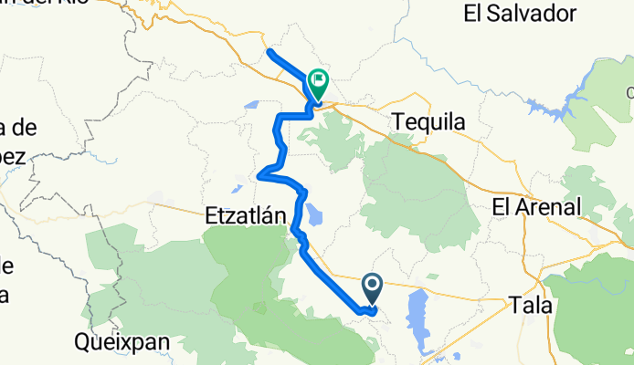
Tequila bike | Magdalena
A cycling route starting in Teuchitlán, Jalisco, Mexico.
Overview
About this route
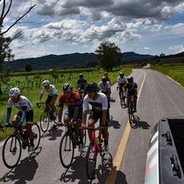
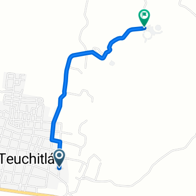
📍ʀᴏᴜᴛᴇ: Hacienda El Carmen - La Quemada - Magdalena -Tequila⏱️ Duration: 2:30 hours🛣️ Distance: 67.5 km⛰️ Elevation: 344 meters🥵 Degree of Difficulty: Moderate🔝 Climb: N/A - 📍ʀᴏᴜᴛᴇ: Hacienda El Carmen - La Quemada - Magdalena -Tequila⏱️ Duration: 2:30 hours🛣️ Distance: 67.5 km⛰️ Elevation: 344 meters🥵 Degree of Difficulty: Moderate🔝 Climb: N/A
- 4 h 11 min
- Duration
- 67.5 km
- Distance
- 289 m
- Ascent
- 195 m
- Descent
- 16.2 km/h
- Avg. speed
- 1,414 m
- Max. altitude

Continue with Bikemap
Use, edit, or download this cycling route
You would like to ride Tequila bike | Magdalena or customize it for your own trip? Here is what you can do with this Bikemap route:
Free features
- Save this route as favorite or in collections
- Copy & plan your own version of this route
- Sync your route with Garmin or Wahoo
Premium features
Free trial for 3 days, or one-time payment. More about Bikemap Premium.
- Navigate this route on iOS & Android
- Export a GPX / KML file of this route
- Create your custom printout (try it for free)
- Download this route for offline navigation
Discover more Premium features.
Get Bikemap PremiumFrom our community
Other popular routes starting in Teuchitlán
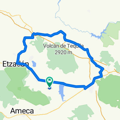 Tequila bike | Tequila Volcano
- Distance
- 132.5 km
- Ascent
- 782 m
- Descent
- 782 m
- Location
- Teuchitlán, Jalisco, Mexico
 Tequila bike | Santa Rosa 2
- Distance
- 121 km
- Ascent
- 2,082 m
- Descent
- 2,114 m
- Location
- Teuchitlán, Jalisco, Mexico
 Tequila bike | Vías Verdes 2
- Distance
- 75.4 km
- Ascent
- 653 m
- Descent
- 665 m
- Location
- Teuchitlán, Jalisco, Mexico
 Tequila bike | Plan de Barrancas
- Distance
- 169 km
- Ascent
- 1,355 m
- Descent
- 1,355 m
- Location
- Teuchitlán, Jalisco, Mexico
 Ruta desde Calle Independencia Ote, Las Fuentes
- Distance
- 2.2 km
- Ascent
- 104 m
- Descent
- 8 m
- Location
- Teuchitlán, Jalisco, Mexico
 Tequila bike | Tequila
- Distance
- 71.6 km
- Ascent
- 342 m
- Descent
- 432 m
- Location
- Teuchitlán, Jalisco, Mexico
 Tequila bike | San Marcos
- Distance
- 72.8 km
- Ascent
- 640 m
- Descent
- 552 m
- Location
- Teuchitlán, Jalisco, Mexico
 Ruta desde Calle Corregidora S 10, Teuchitlán
- Distance
- 2.1 km
- Ascent
- 100 m
- Descent
- 0 m
- Location
- Teuchitlán, Jalisco, Mexico
Open it in the app