
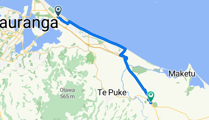
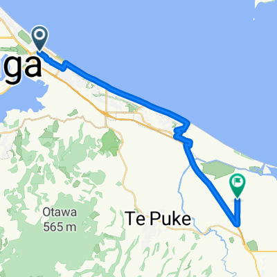
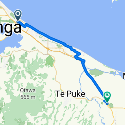
Grenada St, Mount Maunganui to Te Puke Hwy, Paengaroa
A cycling route starting in Tauranga, Bay of Plenty Region, New Zealand.
Overview
About this route
Pedal your way along a scenic 24.7 km route that rewards with gentle ascents and descents. Starting at a manageable 16 meters, you'll climb to a peak elevation of 18 meters, offering a rewarding challenge for cycling enthusiasts. Experience a smooth 9-meter descent, providing a refreshing finish to your ride. Perfect for all skill levels, this route blends easy climbs with a gentle incline, making it ideal for leisurely rides or those looking to enjoy a pleasant, fitness-boosting journey.
AI generated
- 1 h 4 min
- Duration
- 24.7 km
- Distance
- 17 m
- Ascent
- 9 m
- Descent
- 23.2 km/h
- Avg. speed
- 19 m
- Max. altitude

Route quality
Waytypes & surfaces along the route
Waytypes
Cycleway
11.9 km
(48 %)
Road
5.9 km
(24 %)
Surfaces
Paved
22.8 km
(92 %)
Unpaved
1.2 km
(5 %)
Asphalt
19.1 km
(77 %)
Concrete
3.7 km
(15 %)
Continue with Bikemap
Use, edit, or download this cycling route
You would like to ride Grenada St, Mount Maunganui to Te Puke Hwy, Paengaroa or customize it for your own trip? Here is what you can do with this Bikemap route:
Free features
- Save this route as favorite or in collections
- Copy & plan your own version of this route
- Sync your route with Garmin or Wahoo
Premium features
Free trial for 3 days, or one-time payment. More about Bikemap Premium.
- Navigate this route on iOS & Android
- Export a GPX / KML file of this route
- Create your custom printout (try it for free)
- Download this route for offline navigation
Discover more Premium features.
Get Bikemap PremiumFrom our community
Other popular routes starting in Tauranga
 Last training ride
- Distance
- 25.8 km
- Ascent
- 24 m
- Descent
- 26 m
- Location
- Tauranga, Bay of Plenty Region, New Zealand
 Fraser Street to Clivedene Street
- Distance
- 8.8 km
- Ascent
- 50 m
- Descent
- 52 m
- Location
- Tauranga, Bay of Plenty Region, New Zealand
 Mount Maunganui to Mount Maunganui
- Distance
- 50.2 km
- Ascent
- 25 m
- Descent
- 24 m
- Location
- Tauranga, Bay of Plenty Region, New Zealand
 Tauranga Lawn Tennis Club
- Distance
- 12.8 km
- Ascent
- 97 m
- Descent
- 92 m
- Location
- Tauranga, Bay of Plenty Region, New Zealand
 From Mount Maunganui to Paengaroa
- Distance
- 25.5 km
- Ascent
- 31 m
- Descent
- 25 m
- Location
- Tauranga, Bay of Plenty Region, New Zealand
 Sutton Way to Fifteenth Avenue
- Distance
- 7.3 km
- Ascent
- 102 m
- Descent
- 90 m
- Location
- Tauranga, Bay of Plenty Region, New Zealand
 Tauranga nach Waihi
- Distance
- 51.8 km
- Ascent
- 535 m
- Descent
- 542 m
- Location
- Tauranga, Bay of Plenty Region, New Zealand
 EC Omotai Morning Loop
- Distance
- 12.5 km
- Ascent
- 555 m
- Descent
- 556 m
- Location
- Tauranga, Bay of Plenty Region, New Zealand
Open it in the app