
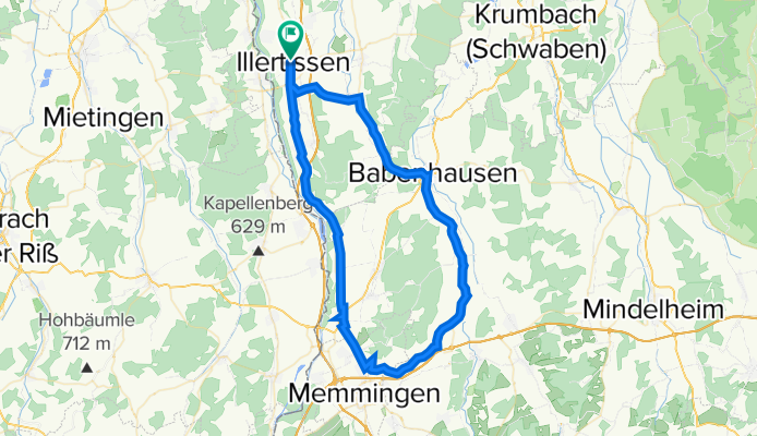
Illertissen, Memmingen, Holzgünz, Babenhausen, Illertissen
A cycling route starting in Illertissen, Bavaria, Germany.
Overview
About this route
Max. Steigung 10%
Für Kletter spezialisten, kann man auch über Eisenburg fahren. Da sich die Steigung sehr lange zieht und immer Steiler wird.
- -:--
- Duration
- 67.1 km
- Distance
- 171 m
- Ascent
- 166 m
- Descent
- ---
- Avg. speed
- ---
- Avg. speed
Route quality
Waytypes & surfaces along the route
Waytypes
Busy road
32.3 km
(48 %)
Quiet road
12.9 km
(19 %)
Surfaces
Paved
49.8 km
(74 %)
Unpaved
0.1 km
(<1 %)
Asphalt
49 km
(73 %)
Paved (undefined)
0.8 km
(1 %)
Continue with Bikemap
Use, edit, or download this cycling route
You would like to ride Illertissen, Memmingen, Holzgünz, Babenhausen, Illertissen or customize it for your own trip? Here is what you can do with this Bikemap route:
Free features
- Save this route as favorite or in collections
- Copy & plan your own version of this route
- Sync your route with Garmin or Wahoo
Premium features
Free trial for 3 days, or one-time payment. More about Bikemap Premium.
- Navigate this route on iOS & Android
- Export a GPX / KML file of this route
- Create your custom printout (try it for free)
- Download this route for offline navigation
Discover more Premium features.
Get Bikemap PremiumFrom our community
Other popular routes starting in Illertissen
 Oberschwaben- Abstecher 2018
- Distance
- 80.6 km
- Ascent
- 382 m
- Descent
- 381 m
- Location
- Illertissen, Bavaria, Germany
 Großen Runde Illertissen-Pfaffenhofen
- Distance
- 42.7 km
- Ascent
- 89 m
- Descent
- 97 m
- Location
- Illertissen, Bavaria, Germany
 Südl. von Jedesheim
- Distance
- 52.3 km
- Ascent
- 253 m
- Descent
- 257 m
- Location
- Illertissen, Bavaria, Germany
 Ill-Rothtal_24-var-3
- Distance
- 23.4 km
- Ascent
- 123 m
- Descent
- 121 m
- Location
- Illertissen, Bavaria, Germany
 Illertissen-Oberstdorf
- Distance
- 103.7 km
- Ascent
- 501 m
- Descent
- 202 m
- Location
- Illertissen, Bavaria, Germany
 Hörenhausen auf Umwegen
- Distance
- 29.4 km
- Ascent
- 198 m
- Descent
- 198 m
- Location
- Illertissen, Bavaria, Germany
 Illertissen - Rundtour ins Osterbachtal
- Distance
- 72.6 km
- Ascent
- 605 m
- Descent
- 613 m
- Location
- Illertissen, Bavaria, Germany
 Zum Picknick an den Fuggerweiher
- Distance
- 55.3 km
- Ascent
- 380 m
- Descent
- 386 m
- Location
- Illertissen, Bavaria, Germany
Open it in the app