
신천동, 서울특별시에서 신천동, 서울특별시까지
A cycling route starting in Hanam, Gyeonggi-do, South Korea.
Overview
About this route
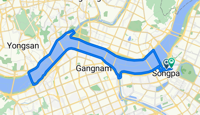
You'll embark on a 28.4-kilometer journey, with a gentle climb of 190 meters and a graceful descent of 221 meters. The highest point on this route stands at 86 meters, offering breathtaking views along the way.
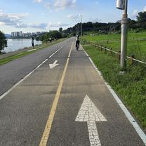
The path is mostly paved, making it ideal for cyclists seeking a smooth and enjoyable ride. Whether you're a seasoned cyclist or a weekend enthusiast, this route promises a rewarding experience for all.
AI generated
- 2 h 18 min
- Duration
- 28.4 km
- Distance
- 190 m
- Ascent
- 222 m
- Descent
- 12.4 km/h
- Avg. speed
- 86 m
- Max. altitude

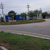
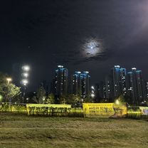
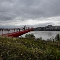
Route photos


Route quality
Waytypes & surfaces along the route
Waytypes
Cycleway
23.3 km
(82 %)
Pedestrian area
2.6 km
(9 %)
Surfaces
Paved
24.7 km
(87 %)
Asphalt
23.3 km
(82 %)
Paved (undefined)
1.4 km
(5 %)
Undefined
3.7 km
(13 %)
Continue with Bikemap
Use, edit, or download this cycling route
You would like to ride 신천동, 서울특별시에서 신천동, 서울특별시까지 or customize it for your own trip? Here is what you can do with this Bikemap route:
Free features
- Save this route as favorite or in collections
- Copy & plan your own version of this route
- Sync your route with Garmin or Wahoo
Premium features
Free trial for 3 days, or one-time payment. More about Bikemap Premium.
- Navigate this route on iOS & Android
- Export a GPX / KML file of this route
- Create your custom printout (try it for free)
- Download this route for offline navigation
Discover more Premium features.
Get Bikemap PremiumFrom our community
Other popular routes starting in Hanam
![Ph0]에서 경로양서면](https://media.bikemap.net/routes/17638240/gallery/thumbs/8494bba0-b649-4e06-920a-fa8b786083ac.jpg.208x208_q80_crop.jpg) Ph0]에서 경로양서면
Ph0]에서 경로양서면- Distance
- 35.1 km
- Ascent
- 143 m
- Descent
- 160 m
- Location
- Hanam, Gyeonggi-do, South Korea
![조안면 285-1Ph0]으로 라우팅](https://media.bikemap.net/routes/17339758/gallery/thumbs/0b6801bb-18f7-4791-8a94-cadb4df445d1.jpg.208x208_q80_crop.jpg) 조안면 285-1Ph0]으로 라우팅
조안면 285-1Ph0]으로 라우팅- Distance
- 20.2 km
- Ascent
- 129 m
- Descent
- 131 m
- Location
- Hanam, Gyeonggi-do, South Korea
 신장동 ~ 조안면 404-2
- Distance
- 9.4 km
- Ascent
- 114 m
- Descent
- 140 m
- Location
- Hanam, Gyeonggi-do, South Korea
 방이동, 서울특별시에서 강동대로, 서울특별시까지
- Distance
- 28.4 km
- Ascent
- 116 m
- Descent
- 122 m
- Location
- Hanam, Gyeonggi-do, South Korea
 신천동, 서울특별시에서 신천동, 서울특별시까지
- Distance
- 28.4 km
- Ascent
- 190 m
- Descent
- 222 m
- Location
- Hanam, Gyeonggi-do, South Korea
 편안한 경로
- Distance
- 28.2 km
- Ascent
- 326 m
- Descent
- 357 m
- Location
- Hanam, Gyeonggi-do, South Korea
 인덕원 팔당
- Distance
- 47.1 km
- Ascent
- 274 m
- Descent
- 270 m
- Location
- Hanam, Gyeonggi-do, South Korea
 반포 라이딩
- Distance
- 25.5 km
- Ascent
- 80 m
- Descent
- 66 m
- Location
- Hanam, Gyeonggi-do, South Korea
Open it in the app