
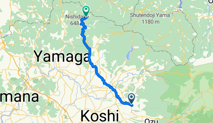
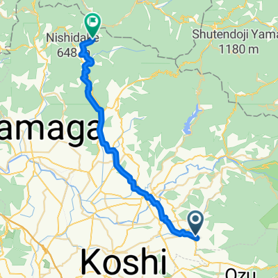
旭志小原, 菊池市へ鹿北町椎持, 山鹿市
A cycling route starting in Kikuchi, Kumamoto, Japan.
Overview
About this route
2025.10.19走行会
- 2 h 30 min
- Duration
- 34.2 km
- Distance
- 1,154 m
- Ascent
- 997 m
- Descent
- 13.7 km/h
- Avg. speed
- 538 m
- Max. altitude
Route quality
Waytypes & surfaces along the route
Waytypes
Quiet road
29.4 km
(86 %)
Road
2.4 km
(7 %)
Continue with Bikemap
Use, edit, or download this cycling route
You would like to ride 旭志小原, 菊池市へ鹿北町椎持, 山鹿市 or customize it for your own trip? Here is what you can do with this Bikemap route:
Free features
- Save this route as favorite or in collections
- Copy & plan your own version of this route
- Sync your route with Garmin or Wahoo
Premium features
Free trial for 3 days, or one-time payment. More about Bikemap Premium.
- Navigate this route on iOS & Android
- Export a GPX / KML file of this route
- Create your custom printout (try it for free)
- Download this route for offline navigation
Discover more Premium features.
Get Bikemap PremiumFrom our community
Other popular routes starting in Kikuchi
 809-1, Shichijomachiokada, Kikuchi to 306, Shichijomachiokada, Kikuchi
- Distance
- 1 km
- Ascent
- 0 m
- Descent
- 38 m
- Location
- Kikuchi, Kumamoto, Japan
 325, Shichijomachiokada, Kikuchi to 1080, Komorikita, Kikuchi
- Distance
- 7.9 km
- Ascent
- 104 m
- Descent
- 49 m
- Location
- Kikuchi, Kumamoto, Japan
 水めぐりコース
- Distance
- 25.8 km
- Ascent
- 125 m
- Descent
- 124 m
- Location
- Kikuchi, Kumamoto, Japan
 旭志小原, 菊池市へ鹿北町椎持, 山鹿市
- Distance
- 34.2 km
- Ascent
- 1,154 m
- Descent
- 997 m
- Location
- Kikuchi, Kumamoto, Japan
 阿蘇・菊池渓谷コース
- Distance
- 58.2 km
- Ascent
- 1,437 m
- Descent
- 1,436 m
- Location
- Kikuchi, Kumamoto, Japan
 1570-1, Takanose, Kikuchi to 809-1, Shichijomachiokada, Kikuchi
- Distance
- 5.2 km
- Ascent
- 68 m
- Descent
- 80 m
- Location
- Kikuchi, Kumamoto, Japan
 菊池グリーンロード, 菊池市 to 隈府1272-2, 菊池市
- Distance
- 10.8 km
- Ascent
- 85 m
- Descent
- 171 m
- Location
- Kikuchi, Kumamoto, Japan
 Kikuchi Green Road, Kikuchi to 1272-10, Waifu, Kikuchi
- Distance
- 9.2 km
- Ascent
- 125 m
- Descent
- 158 m
- Location
- Kikuchi, Kumamoto, Japan
Open it in the app