
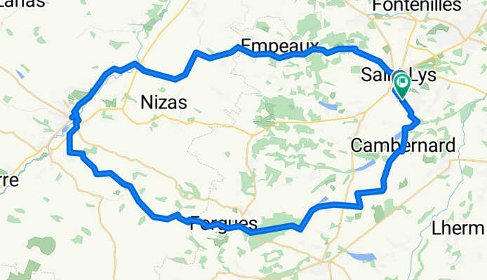
60 km Samatan
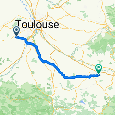
A cycling route starting in Saint-Lys, Occitanie, France.
Overview
About this route
- 3 h 48 min
- Duration
- 61 km
- Distance
- 588 m
- Ascent
- 587 m
- Descent
- 16 km/h
- Avg. speed
- 318 m
- Max. altitude
Route quality
Waytypes & surfaces along the route
Waytypes
Quiet road
28.1 km
(46 %)
Road
22.6 km
(37 %)
Surfaces
Paved
7.3 km
(12 %)
Unpaved
1.2 km
(2 %)
Asphalt
7.3 km
(12 %)
Gravel
1.2 km
(2 %)
Undefined
52.5 km
(86 %)
Continue with Bikemap
Use, edit, or download this cycling route
You would like to ride 60 km Samatan or customize it for your own trip? Here is what you can do with this Bikemap route:
Free features
- Save this route as favorite or in collections
- Copy & plan your own version of this route
- Sync your route with Garmin or Wahoo
Premium features
Free trial for 3 days, or one-time payment. More about Bikemap Premium.
- Navigate this route on iOS & Android
- Export a GPX / KML file of this route
- Create your custom printout (try it for free)
- Download this route for offline navigation
Discover more Premium features.
Get Bikemap PremiumFrom our community
Other popular routes starting in Saint-Lys
 MZ02 Saint-Lys to Montreal (Alzonne)
- Distance
- 104.4 km
- Ascent
- 583 m
- Descent
- 528 m
- Location
- Saint-Lys, Occitanie, France
 95 Chemin de Pédaouba, Saint-Lys à 1B Impasse des Coquelicots, Saint-Lys
- Distance
- 1.9 km
- Ascent
- 54 m
- Descent
- 27 m
- Location
- Saint-Lys, Occitanie, France
 1–3 Impasse des Coquelicots, Saint-Lys à 105 Chemin de Pédaouba, Saint-Lys
- Distance
- 5.3 km
- Ascent
- 389 m
- Descent
- 436 m
- Location
- Saint-Lys, Occitanie, France
 1 Impasse des Coquelicots, Saint-Lys à 3 Allée du Gazailla, Saint-Lys
- Distance
- 3.3 km
- Ascent
- 229 m
- Descent
- 218 m
- Location
- Saint-Lys, Occitanie, France
 Boucle Occitaman
- Distance
- 74 km
- Ascent
- 485 m
- Descent
- 481 m
- Location
- Saint-Lys, Occitanie, France
 De 461 Route de Saiguède, Saint-Lys à 4 Rue Valmirande, Plaisance-du-Touch
- Distance
- 10 km
- Ascent
- 19 m
- Descent
- 78 m
- Location
- Saint-Lys, Occitanie, France
 De ?dº÷? à ?dº÷?
- Distance
- 30.8 km
- Ascent
- 166 m
- Descent
- 166 m
- Location
- Saint-Lys, Occitanie, France
 Chemin des Nauzes, Saint-Lys à Chemin des Nauzes, Saint-Lys
- Distance
- 25.5 km
- Ascent
- 78 m
- Descent
- 79 m
- Location
- Saint-Lys, Occitanie, France
Open it in the app