
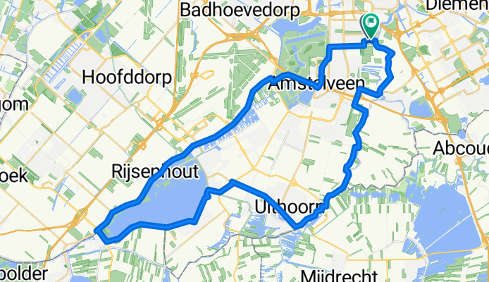
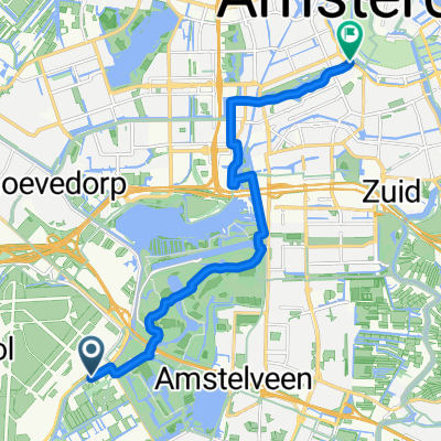
Route in Amsterdam
A cycling route starting in Amstelveen, North Holland, The Netherlands.
Overview
About this route
- 2 h 59 min
- Duration
- 52.6 km
- Distance
- 50 m
- Ascent
- 54 m
- Descent
- 17.6 km/h
- Avg. speed
- 8 m
- Max. altitude
Route quality
Waytypes & surfaces along the route
Waytypes
Cycleway
22.6 km
(43 %)
Road
20.5 km
(39 %)
Surfaces
Paved
20.5 km
(39 %)
Asphalt
20.5 km
(39 %)
Undefined
32.1 km
(61 %)
Continue with Bikemap
Use, edit, or download this cycling route
You would like to ride Route in Amsterdam or customize it for your own trip? Here is what you can do with this Bikemap route:
Free features
- Save this route as favorite or in collections
- Copy & plan your own version of this route
- Sync your route with Garmin or Wahoo
Premium features
Free trial for 3 days, or one-time payment. More about Bikemap Premium.
- Navigate this route on iOS & Android
- Export a GPX / KML file of this route
- Create your custom printout (try it for free)
- Download this route for offline navigation
Discover more Premium features.
Get Bikemap PremiumFrom our community
Other popular routes starting in Amstelveen
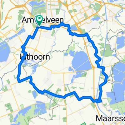 Rondje Breukelen
- Distance
- 66.3 km
- Ascent
- 51 m
- Descent
- 55 m
- Location
- Amstelveen, North Holland, The Netherlands
 01 Amsterdam to Almere
- Distance
- 31.4 km
- Ascent
- 55 m
- Descent
- 61 m
- Location
- Amstelveen, North Holland, The Netherlands
 Stadsplein, Amstelveen naar Valentijnkade, Amsterdam
- Distance
- 13.3 km
- Ascent
- 21 m
- Descent
- 19 m
- Location
- Amstelveen, North Holland, The Netherlands
 Westeinderplassen 47km
- Distance
- 47.2 km
- Ascent
- 8 m
- Descent
- 8 m
- Location
- Amstelveen, North Holland, The Netherlands
 Route in Amsterdam
- Distance
- 52.6 km
- Ascent
- 50 m
- Descent
- 54 m
- Location
- Amstelveen, North Holland, The Netherlands
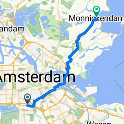 1 Amsterdam to Monnickendam
- Distance
- 22.5 km
- Ascent
- 18 m
- Descent
- 17 m
- Location
- Amstelveen, North Holland, The Netherlands
 Route to Hard Rock Cafe
- Distance
- 12.7 km
- Ascent
- 36 m
- Descent
- 26 m
- Location
- Amstelveen, North Holland, The Netherlands
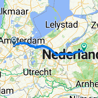 Fokkerstraat naar Apeldoornseweg
- Distance
- 85.7 km
- Ascent
- 184 m
- Descent
- 124 m
- Location
- Amstelveen, North Holland, The Netherlands
Open it in the app