

De Avinguda Francesc Tàrrega a Carrer Manuel Sanchis Guarner
A cycling route starting in Vila-real, Valencia, Spain.
Overview
About this route
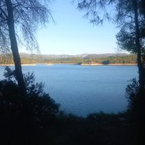
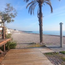
Ride: loop around the Sichar reservoir from Vila-real.
- 9 h 59 min
- Duration
- 61.4 km
- Distance
- 655 m
- Ascent
- 710 m
- Descent
- 6.1 km/h
- Avg. speed
- 241 m
- Max. altitude
Route photos


Route quality
Waytypes & surfaces along the route
Waytypes
Quiet road
27.6 km
(45 %)
Road
22.7 km
(37 %)
Surfaces
Paved
35 km
(57 %)
Unpaved
0.6 km
(1 %)
Asphalt
35 km
(57 %)
Ground
0.6 km
(1 %)
Undefined
25.8 km
(42 %)
Continue with Bikemap
Use, edit, or download this cycling route
You would like to ride De Avinguda Francesc Tàrrega a Carrer Manuel Sanchis Guarner or customize it for your own trip? Here is what you can do with this Bikemap route:
Free features
- Save this route as favorite or in collections
- Copy & plan your own version of this route
- Sync your route with Garmin or Wahoo
Premium features
Free trial for 3 days, or one-time payment. More about Bikemap Premium.
- Navigate this route on iOS & Android
- Export a GPX / KML file of this route
- Create your custom printout (try it for free)
- Download this route for offline navigation
Discover more Premium features.
Get Bikemap PremiumFrom our community
Other popular routes starting in Vila-real
 De Avinguda Francesc Tàrrega a Carrer Manuel Sanchis Guarner
- Distance
- 61.4 km
- Ascent
- 655 m
- Descent
- 710 m
- Location
- Vila-real, Valencia, Spain
 C.R.E Vila-real 2014
- Distance
- 9.8 km
- Ascent
- 52 m
- Descent
- 53 m
- Location
- Vila-real, Valencia, Spain
 META
META- Distance
- 0.8 km
- Ascent
- 8 m
- Descent
- 0 m
- Location
- Vila-real, Valencia, Spain
 Santa Quiteria - Almassora - Riu Millars - Platja - Riu Millars - Vila-real.
- Distance
- 19.6 km
- Ascent
- 52 m
- Descent
- 45 m
- Location
- Vila-real, Valencia, Spain
 Villarreal. montanejos 25 de junio, 9:20
- Distance
- 68.9 km
- Ascent
- 779 m
- Descent
- 418 m
- Location
- Vila-real, Valencia, Spain
 Vila=Real, Moncofar,Vila=Real
- Distance
- 58.6 km
- Ascent
- 209 m
- Descent
- 252 m
- Location
- Vila-real, Valencia, Spain
 Vila-real, Cantera d'Onda, Trialera, Senda Cachonda, Ermita Santa Cristina, Trialera, Toritos, Vila-real.
- Distance
- 48.3 km
- Ascent
- 0 m
- Descent
- 0 m
- Location
- Vila-real, Valencia, Spain
 El Bartolo por La Pobla
- Distance
- 71 km
- Ascent
- 852 m
- Descent
- 887 m
- Location
- Vila-real, Valencia, Spain
Open it in the app