
Von Ceyreste bis Finale Ligure
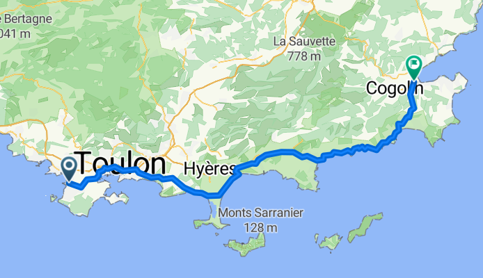
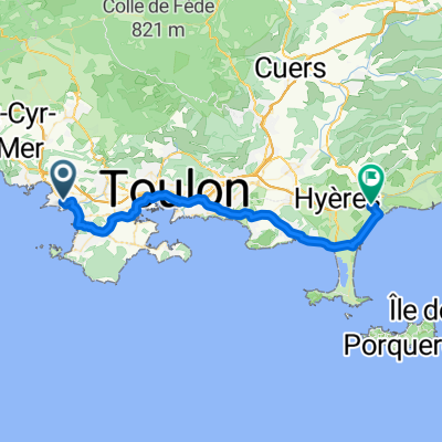
Hyères - Sainte-Maxime
A cycling route starting in Sanary-sur-Mer, Provence-Alpes-Côte d'Azur Region, France.
Overview
About this route
- 5 h 18 min
- Duration
- 89.1 km
- Distance
- 909 m
- Ascent
- 919 m
- Descent
- 16.8 km/h
- Avg. speed
- 118 m
- Max. altitude

Part of
Von Ceyreste bis Finale Ligure
6 stages
Route quality
Waytypes & surfaces along the route
Waytypes
Cycleway
49.9 km
(56 %)
Quiet road
16 km
(18 %)
Surfaces
Paved
73.1 km
(82 %)
Unpaved
1.8 km
(2 %)
Asphalt
69.5 km
(78 %)
Concrete
2.7 km
(3 %)
Continue with Bikemap
Use, edit, or download this cycling route
You would like to ride Hyères - Sainte-Maxime or customize it for your own trip? Here is what you can do with this Bikemap route:
Free features
- Save this route as favorite or in collections
- Copy & plan your own version of this route
- Split it into stages to create a multi-day tour
- Sync your route with Garmin or Wahoo
Premium features
Free trial for 3 days, or one-time payment. More about Bikemap Premium.
- Navigate this route on iOS & Android
- Export a GPX / KML file of this route
- Create your custom printout (try it for free)
- Download this route for offline navigation
Discover more Premium features.
Get Bikemap PremiumFrom our community
Other popular routes starting in Sanary-sur-Mer
 DAY1 SSM to Hyeres
- Distance
- 43.3 km
- Ascent
- 252 m
- Descent
- 275 m
- Location
- Sanary-sur-Mer, Provence-Alpes-Côte d'Azur Region, France
 Sanary-Le Coudon
- Distance
- 26.2 km
- Ascent
- 764 m
- Descent
- 86 m
- Location
- Sanary-sur-Mer, Provence-Alpes-Côte d'Azur Region, France
 Von Six-Fours-020625
- Distance
- 15.9 km
- Ascent
- 393 m
- Descent
- 385 m
- Location
- Sanary-sur-Mer, Provence-Alpes-Côte d'Azur Region, France
 21 mai 2022 le Brusc
- Distance
- 30.8 km
- Ascent
- 278 m
- Descent
- 274 m
- Location
- Sanary-sur-Mer, Provence-Alpes-Côte d'Azur Region, France
 Route des crêtes
- Distance
- 90.1 km
- Ascent
- 1,176 m
- Descent
- 1,176 m
- Location
- Sanary-sur-Mer, Provence-Alpes-Côte d'Azur Region, France
 Hyères - Sainte-Maxime
- Distance
- 89.1 km
- Ascent
- 909 m
- Descent
- 919 m
- Location
- Sanary-sur-Mer, Provence-Alpes-Côte d'Azur Region, France
 14.1_Le Brusc > Signes (par Col de Garde)
- Distance
- 62.6 km
- Ascent
- 943 m
- Descent
- 603 m
- Location
- Sanary-sur-Mer, Provence-Alpes-Côte d'Azur Region, France
 Faron - Mont Caume
- Distance
- 87.6 km
- Ascent
- 1,543 m
- Descent
- 1,515 m
- Location
- Sanary-sur-Mer, Provence-Alpes-Côte d'Azur Region, France
Open it in the app