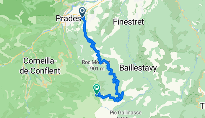


13 Prades - Port Vendres
- 71.5 km
- 409 m
- 766 m
- Prades, Occitanie, France
A cycling route starting in Prades, Occitanie, France.
Overview
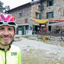
Canigou (2,784 m) is much more than a mountain: it is a natural and cultural emblem of Catalonia and the Eastern Pyrenees. Its silhouette dominates the Roussillon plain and has inspired legends, poems and songs that have made it a genuine identity symbol. Declared a 'Site Classé' in 1983 by the French Ministry of the Environment, the Canigou massif enjoys special protection that safeguards its landscape richness, biodiversity and heritage value. Its surroundings include Mediterranean forests, beechwoods and alpine meadows, together with Romanesque monasteries such as Sant Martí del Canigó or San Miguel de Cuixà, which reinforce its spiritual and cultural magnetism. The whole forms part of a natural area of high ecological and scenic value, where the mountain becomes a meeting point between nature, history and Catalan culture.
created this 1 month ago
\"")
Continue with Bikemap
You would like to ride ASCENSO AL REFUGI DE CORTALETS/ CANIGÓ (por Villerach) or customize it for your own trip? Here is what you can do with this Bikemap route:
Free trial for 3 days, or one-time payment. More about Bikemap Premium.
Discover more Premium features.
Get Bikemap PremiumFrom our community
Open it in the app