
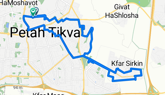
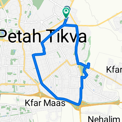
כפר סירקין
A cycling route starting in Petah Tikva, Central District, Israel.
Overview
About this route
- 3 h 50 min
- Duration
- 21.1 km
- Distance
- 172 m
- Ascent
- 134 m
- Descent
- 5.5 km/h
- Avg. speed
- 123 m
- Max. altitude

Continue with Bikemap
Use, edit, or download this cycling route
You would like to ride כפר סירקין or customize it for your own trip? Here is what you can do with this Bikemap route:
Free features
- Save this route as favorite or in collections
- Copy & plan your own version of this route
- Sync your route with Garmin or Wahoo
Premium features
Free trial for 3 days, or one-time payment. More about Bikemap Premium.
- Navigate this route on iOS & Android
- Export a GPX / KML file of this route
- Create your custom printout (try it for free)
- Download this route for offline navigation
Discover more Premium features.
Get Bikemap PremiumFrom our community
Other popular routes starting in Petah Tikva
 מגני התערוכה אל מקורות הירקון
- Distance
- 19 km
- Ascent
- 9 m
- Descent
- 21 m
- Location
- Petah Tikva, Central District, Israel
 הירקון מפתח תקווה לנמל תל אביב
- Distance
- 13.9 km
- Ascent
- 15 m
- Descent
- 30 m
- Location
- Petah Tikva, Central District, Israel
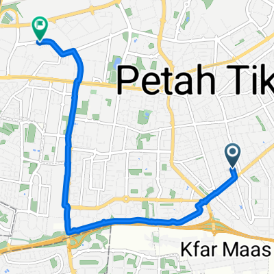 Moderate route
- Distance
- 7.7 km
- Ascent
- 31 m
- Descent
- 92 m
- Location
- Petah Tikva, Central District, Israel
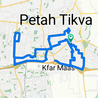 רח׳ האר״י הקדוש, פתח תקווה до רח׳ האר״י הקדוש, פתח תקווה
- Distance
- 21.6 km
- Ascent
- 145 m
- Descent
- 145 m
- Location
- Petah Tikva, Central District, Israel
 כפר סירקין
- Distance
- 21.1 km
- Ascent
- 172 m
- Descent
- 134 m
- Location
- Petah Tikva, Central District, Israel
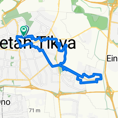
 Relaxed route
- Distance
- 11.4 km
- Ascent
- 106 m
- Descent
- 123 m
- Location
- Petah Tikva, Central District, Israel
 Petah Tikva to Petah Tikva
- Distance
- 72.1 km
- Ascent
- 512 m
- Descent
- 507 m
- Location
- Petah Tikva, Central District, Israel
 Route in Petah Tikva
- Distance
- 7.2 km
- Ascent
- 34 m
- Descent
- 74 m
- Location
- Petah Tikva, Central District, Israel
Open it in the app