

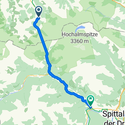
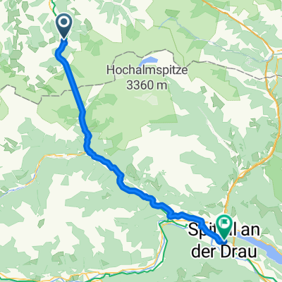
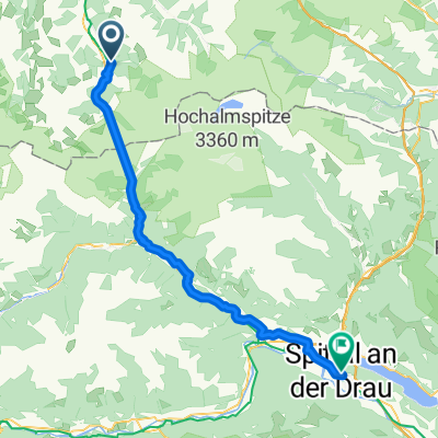
From Bad Gastein to Spittal an der Drau
A cycling route starting in Bad Gastein, Salzburg, Austria.
Overview
About this route
- 3 h 33 min
- Duration
- 59.4 km
- Distance
- 724 m
- Ascent
- 1,196 m
- Descent
- 16.7 km/h
- Avg. speed
- 1,199 m
- Max. altitude

Route quality
Waytypes & surfaces along the route
Waytypes
Quiet road
20.2 km
(34 %)
Cycleway
17.2 km
(29 %)
Surfaces
Paved
18.4 km
(31 %)
Unpaved
4.8 km
(8 %)
Asphalt
17.2 km
(29 %)
Loose gravel
2.4 km
(4 %)
Continue with Bikemap
Use, edit, or download this cycling route
You would like to ride From Bad Gastein to Spittal an der Drau or customize it for your own trip? Here is what you can do with this Bikemap route:
Free features
- Save this route as favorite or in collections
- Copy & plan your own version of this route
- Sync your route with Garmin or Wahoo
Premium features
Free trial for 3 days, or one-time payment. More about Bikemap Premium.
- Navigate this route on iOS & Android
- Export a GPX / KML file of this route
- Create your custom printout (try it for free)
- Download this route for offline navigation
Discover more Premium features.
Get Bikemap PremiumFrom our community
Other popular routes starting in Bad Gastein
 Bad Gastein - Möllbrücke
- Distance
- 44.8 km
- Ascent
- 585 m
- Descent
- 1,119 m
- Location
- Bad Gastein, Salzburg, Austria
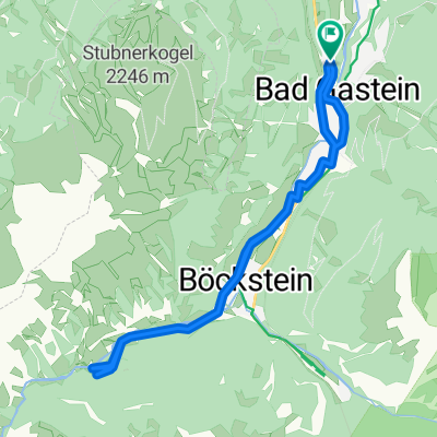
 Stubnerkogel von Bad Gastein
- Distance
- 21.1 km
- Ascent
- 1,501 m
- Descent
- 329 m
- Location
- Bad Gastein, Salzburg, Austria
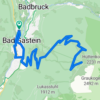 Graukogel Bergstation
- Distance
- 19.9 km
- Ascent
- 1,094 m
- Descent
- 1,095 m
- Location
- Bad Gastein, Salzburg, Austria
 Astenalmen von Bad Gastein
- Distance
- 14 km
- Ascent
- 235 m
- Descent
- 238 m
- Location
- Bad Gastein, Salzburg, Austria
 Von Bad Gastein bis Spittal an der Drau
- Distance
- 58.3 km
- Ascent
- 812 m
- Descent
- 1,327 m
- Location
- Bad Gastein, Salzburg, Austria
 Bad Hofgastein - Mühldorf
- Distance
- 60.7 km
- Ascent
- 1,036 m
- Descent
- 1,349 m
- Location
- Bad Gastein, Salzburg, Austria
 Etappe 3: Von Bad Gastein nach Spittal an der Drau– Alpe-Adria-Radweg
- Distance
- 64 km
- Ascent
- 1,819 m
- Descent
- 2,351 m
- Location
- Bad Gastein, Salzburg, Austria
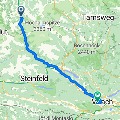 Erlengrund camp-Gerli camp (Villach) 103 km
- Distance
- 102.8 km
- Ascent
- 1,339 m
- Descent
- 1,640 m
- Location
- Bad Gastein, Salzburg, Austria
Open it in the app