

St Andrews Pilgrimage, from southern upland way to edinburgh
A cycling route starting in Innerleithen, Scotland, United Kingdom.
Overview
About this route
- -:--
- Duration
- 65.3 km
- Distance
- 677 m
- Ascent
- 765 m
- Descent
- ---
- Avg. speed
- ---
- Max. altitude
Route highlights
Points of interest along the route

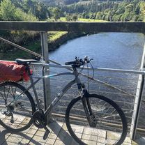
Photo after 0 km
Accommodation after 13.7 km
Campsite
Accommodation after 17.7 km
Hotel
Point of interest after 20.7 km
Tearoom with restaurant
Accommodation after 20.7 km
Inn with rooms
Accommodation after 30.2 km
Pub
Accommodation after 32.3 km
bistro/restaurant
Accommodation after 42.5 km
Inn
Accommodation after 65.3 km
Hostel
Continue with Bikemap
Use, edit, or download this cycling route
You would like to ride St Andrews Pilgrimage, from southern upland way to edinburgh or customize it for your own trip? Here is what you can do with this Bikemap route:
Free features
- Save this route as favorite or in collections
- Copy & plan your own version of this route
- Sync your route with Garmin or Wahoo
Premium features
Free trial for 3 days, or one-time payment. More about Bikemap Premium.
- Navigate this route on iOS & Android
- Export a GPX / KML file of this route
- Create your custom printout (try it for free)
- Download this route for offline navigation
Discover more Premium features.
Get Bikemap PremiumFrom our community
Other popular routes starting in Innerleithen
 Innerleithan
- Distance
- 59.9 km
- Ascent
- 1,421 m
- Descent
- 1,423 m
- Location
- Innerleithen, Scotland, United Kingdom
 Day 2 - Innerleithen to Berwick on Tweed #PelotonToWimbledon
- Distance
- 101.1 km
- Ascent
- 339 m
- Descent
- 459 m
- Location
- Innerleithen, Scotland, United Kingdom
 Marmion Cottage, Innerleithen to High Street, Peebles
- Distance
- 13.1 km
- Ascent
- 80 m
- Descent
- 68 m
- Location
- Innerleithen, Scotland, United Kingdom
 Route England/Scotland day 16
- Distance
- 114.7 km
- Ascent
- 403 m
- Descent
- 540 m
- Location
- Innerleithen, Scotland, United Kingdom
 borders loop
- Distance
- 84.6 km
- Ascent
- 675 m
- Descent
- 676 m
- Location
- Innerleithen, Scotland, United Kingdom
 St Andrews Pilgrimage, from southern upland way to edinburgh
- Distance
- 65.3 km
- Ascent
- 677 m
- Descent
- 765 m
- Location
- Innerleithen, Scotland, United Kingdom
 Pre-afternoon tea cycle
- Distance
- 63.1 km
- Ascent
- 512 m
- Descent
- 507 m
- Location
- Innerleithen, Scotland, United Kingdom
 St Wilfrid's Way-Innerleithen via Cardrona to Peebles
- Distance
- 12 km
- Ascent
- 141 m
- Descent
- 139 m
- Location
- Innerleithen, Scotland, United Kingdom
Open it in the app