
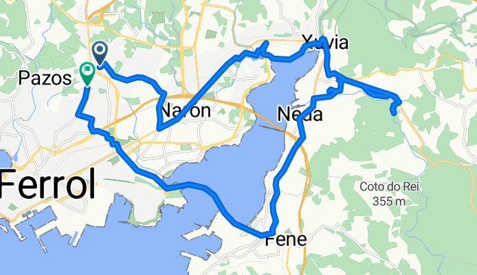
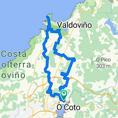
Estrada de Catabois s/n to Estrada de Catabois
A cycling route starting in Narón, Galicia, Spain.
Overview
About this route
- 1 h 55 min
- Duration
- 26.4 km
- Distance
- 295 m
- Ascent
- 291 m
- Descent
- 13.8 km/h
- Avg. speed
- 73 m
- Max. altitude

Continue with Bikemap
Use, edit, or download this cycling route
You would like to ride Estrada de Catabois s/n to Estrada de Catabois or customize it for your own trip? Here is what you can do with this Bikemap route:
Free features
- Save this route as favorite or in collections
- Copy & plan your own version of this route
- Sync your route with Garmin or Wahoo
Premium features
Free trial for 3 days, or one-time payment. More about Bikemap Premium.
- Navigate this route on iOS & Android
- Export a GPX / KML file of this route
- Create your custom printout (try it for free)
- Download this route for offline navigation
Discover more Premium features.
Get Bikemap PremiumFrom our community
Other popular routes starting in Narón
 Estrada de Catabois s/n to Estrada de Catabois
- Distance
- 26.4 km
- Ascent
- 295 m
- Descent
- 291 m
- Location
- Narón, Galicia, Spain
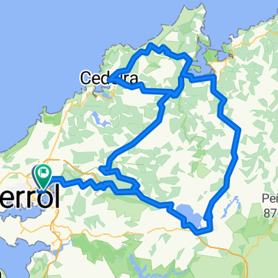 5 Puertos Ferrolterra
- Distance
- 182.2 km
- Ascent
- 2,302 m
- Descent
- 2,300 m
- Location
- Narón, Galicia, Spain
 Galicia-03 : Ferrol - Ortigueira
- Distance
- 78.2 km
- Ascent
- 1,752 m
- Descent
- 1,816 m
- Location
- Narón, Galicia, Spain
 Narón - Roxal - Aurela - A Serra - Narón
- Distance
- 98.2 km
- Ascent
- 1,266 m
- Descent
- 1,266 m
- Location
- Narón, Galicia, Spain
 Ruta de Canido Ida
- Distance
- 17.3 km
- Ascent
- 115 m
- Descent
- 218 m
- Location
- Narón, Galicia, Spain
 Gravel ride Narón
- Distance
- 36.9 km
- Ascent
- 0 m
- Descent
- 0 m
- Location
- Narón, Galicia, Spain
 Canto a(f/g)ónico "a capella" 3
- Distance
- 40.1 km
- Ascent
- 822 m
- Descent
- 822 m
- Location
- Narón, Galicia, Spain
 (En construcción...)
- Distance
- 118.2 km
- Ascent
- 1,472 m
- Descent
- 1,384 m
- Location
- Narón, Galicia, Spain
Open it in the app