
De Sanchidrián a Torre Val de San Pedro
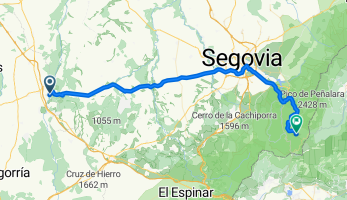
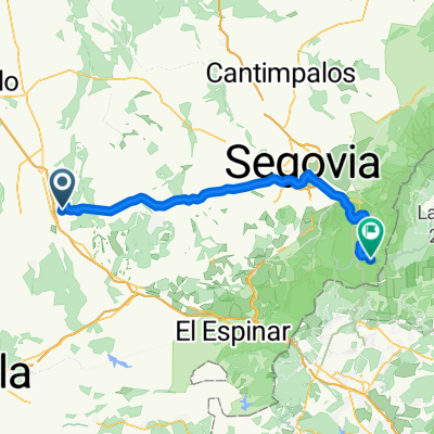
Sanchidrián - La Granja de San Ildefonso
A cycling route starting in Sanchidrián, Castille and León, Spain.
Overview
About this route
- 4 h 33 min
- Duration
- 68.4 km
- Distance
- 1,248 m
- Ascent
- 620 m
- Descent
- 15.1 km/h
- Avg. speed
- 1,604 m
- Max. altitude
Part of
Route quality
Waytypes & surfaces along the route
Waytypes
Road
29.4 km
(43 %)
Quiet road
21.2 km
(31 %)
Surfaces
Paved
51.3 km
(75 %)
Unpaved
10.3 km
(15 %)
Asphalt
50.6 km
(74 %)
Gravel
8.9 km
(13 %)
Continue with Bikemap
Use, edit, or download this cycling route
You would like to ride Sanchidrián - La Granja de San Ildefonso or customize it for your own trip? Here is what you can do with this Bikemap route:
Free features
- Save this route as favorite or in collections
- Copy & plan your own version of this route
- Sync your route with Garmin or Wahoo
Premium features
Free trial for 3 days, or one-time payment. More about Bikemap Premium.
- Navigate this route on iOS & Android
- Export a GPX / KML file of this route
- Create your custom printout (try it for free)
- Download this route for offline navigation
Discover more Premium features.
Get Bikemap PremiumFrom our community
Other popular routes starting in Sanchidrián
 Sanchidrián - La Granja de San Ildefonso
- Distance
- 68.4 km
- Ascent
- 1,248 m
- Descent
- 620 m
- Location
- Sanchidrián, Castille and León, Spain
 De Calle Calzada Vieja 22, Sanchidrián a N-VI 103, Sanchidrián
- Distance
- 1.1 km
- Ascent
- 3 m
- Descent
- 3 m
- Location
- Sanchidrián, Castille and León, Spain
 De Plaza Mayor, 7, Sanchidrián a Calle Jupiter, 22, Maello
- Distance
- 6.1 km
- Ascent
- 63 m
- Descent
- 23 m
- Location
- Sanchidrián, Castille and León, Spain
Open it in the app