
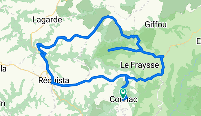
Connac-Circle through Lebous, Sérieux, and Réquista
A cycling route starting in Réquista, Occitanie, France.
Overview
About this route
This circle from Connac included some outstanding small roads running through very scenic mostly agricultural countryside. The way French people maintain the land continues to impress and amaze us. One wrong turn led us to a quickly deteriorating road from which we turned back, retracing our steps to a prior fork in the road. Taking the other fork, we continued on, eventually making it to Réquista before turning east on D44 to return to Connac.
We highly recommend this ride.
- 3 h 20 min
- Duration
- 38.5 km
- Distance
- 710 m
- Ascent
- 704 m
- Descent
- 11.6 km/h
- Avg. speed
- 718 m
- Max. altitude

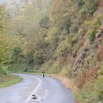
Route photos


Route quality
Waytypes & surfaces along the route
Waytypes
Road
13.5 km
(35 %)
Quiet road
10.8 km
(28 %)
Surfaces
Paved
4.6 km
(12 %)
Asphalt
4.6 km
(12 %)
Undefined
33.8 km
(88 %)
Continue with Bikemap
Use, edit, or download this cycling route
You would like to ride Connac-Circle through Lebous, Sérieux, and Réquista or customize it for your own trip? Here is what you can do with this Bikemap route:
Free features
- Save this route as favorite or in collections
- Copy & plan your own version of this route
- Sync your route with Garmin or Wahoo
Premium features
Free trial for 3 days, or one-time payment. More about Bikemap Premium.
- Navigate this route on iOS & Android
- Export a GPX / KML file of this route
- Create your custom printout (try it for free)
- Download this route for offline navigation
Discover more Premium features.
Get Bikemap PremiumFrom our community
Other popular routes starting in Réquista
 Rondje Solage 1
- Distance
- 45.2 km
- Ascent
- 981 m
- Descent
- 982 m
- Location
- Réquista, Occitanie, France
 rondje camping du batut
- Distance
- 33.7 km
- Ascent
- 485 m
- Descent
- 489 m
- Location
- Réquista, Occitanie, France
 Brasc - Belmount-sur-Rance
- Distance
- 42.6 km
- Ascent
- 641 m
- Descent
- 673 m
- Location
- Réquista, Occitanie, France
 Lincou- Rodez (Nr. 106)
- Distance
- 52.4 km
- Ascent
- 992 m
- Descent
- 665 m
- Location
- Réquista, Occitanie, France
 Connac to Albi via Tarn River Route
- Distance
- 54.1 km
- Ascent
- 1,182 m
- Descent
- 1,543 m
- Location
- Réquista, Occitanie, France
 Solages - Gaillac (Terrisses)
- Distance
- 78.7 km
- Ascent
- 197 m
- Descent
- 443 m
- Location
- Réquista, Occitanie, France
 Connac - Circle through Lincou and Réquista
- Distance
- 21 km
- Ascent
- 562 m
- Descent
- 563 m
- Location
- Réquista, Occitanie, France
 Connac-Circle through Lebous, Sérieux, and Réquista
- Distance
- 38.5 km
- Ascent
- 710 m
- Descent
- 704 m
- Location
- Réquista, Occitanie, France
Open it in the app