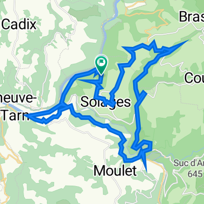
Connac to Albi via Tarn River Route
- 54.1 km
- 1,182 m
- 1,543 m
- Réquista, Occitanie, France
A cycling route starting in Réquista, Occitanie, France.
Overview
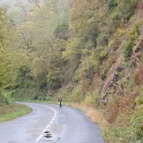
Despite the rain and wind we had to pedal through for more than three-quarters of today's ride, this was a wonderful route with a lot of beautiful scenery. The entrance into Ambialet is particularly scenic. Except upon entering St-Juéry and then getting into Albi, there was virtually no traffic on any of these roads.
Note that there are a few tunnels. The 300 meter tunnel by Lincou has only colored side lights and no overhead lights. So, when going through it, you should have both a head light and tail light. As for the two tunnels on D172 between Ambialet and St-Juéry, they both have adequate lighting, though it would be good to have a tail-light.
We highly recommend this ride.
created this 6 months ago


Route quality
Road
30.3 km
56 %
Track
3.2 km
6 %
Paved
41.7 km
(77 %)
Asphalt
41.7 km
77 %
Undefined
12.5 km
23 %
Continue with Bikemap
You would like to ride Connac to Albi via Tarn River Route or customize it for your own trip? Here is what you can do with this Bikemap route:
Free trial for 3 days, or one-time payment. More about Bikemap Premium.
Discover more Premium features.
Get Bikemap PremiumFrom our community
Open it in the app