

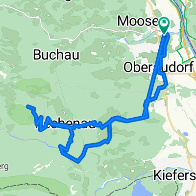
Sonntagsrunde
A cycling route starting in Oberaudorf, Bavaria, Germany.
Overview
About this route
the roads are good; scenically really beautiful. You are mostly in the valley with mountains on the left and right. The lake shortly after Ruhpolding is also very beautiful
the route has a few short climbs and long but rather flat sections. The descents are okay and not dangerous
I must say: a really great loop
- -:--
- Duration
- 151.5 km
- Distance
- 2,198 m
- Ascent
- 2,029 m
- Descent
- ---
- Avg. speed
- 782 m
- Max. altitude

Route quality
Waytypes & surfaces along the route
Waytypes
Path
16.7 km
(11 %)
Quiet road
9.1 km
(6 %)
Surfaces
Paved
130.3 km
(86 %)
Unpaved
12.1 km
(8 %)
Asphalt
128.8 km
(85 %)
Gravel
9.1 km
(6 %)
Continue with Bikemap
Use, edit, or download this cycling route
You would like to ride Sonntagsrunde or customize it for your own trip? Here is what you can do with this Bikemap route:
Free features
- Save this route as favorite or in collections
- Copy & plan your own version of this route
- Split it into stages to create a multi-day tour
- Sync your route with Garmin or Wahoo
Premium features
Free trial for 3 days, or one-time payment. More about Bikemap Premium.
- Navigate this route on iOS & Android
- Export a GPX / KML file of this route
- Create your custom printout (try it for free)
- Download this route for offline navigation
Discover more Premium features.
Get Bikemap PremiumFrom our community
Other popular routes starting in Oberaudorf
 MTB Kids & Family Tatzelwurm
- Distance
- 30.9 km
- Ascent
- 1,065 m
- Descent
- 1,046 m
- Location
- Oberaudorf, Bavaria, Germany
 Erlerberg Trockental
- Distance
- 37.5 km
- Ascent
- 1,186 m
- Descent
- 1,186 m
- Location
- Oberaudorf, Bavaria, Germany
 Erlerbergrunde
- Distance
- 23.4 km
- Ascent
- 740 m
- Descent
- 740 m
- Location
- Oberaudorf, Bavaria, Germany
 Rennradrunde über Sudelfeld
- Distance
- 54.2 km
- Ascent
- 915 m
- Descent
- 915 m
- Location
- Oberaudorf, Bavaria, Germany
 PWOZKS 3: Oberaudorf-Fieberbrunn, 63,5km 880hm
- Distance
- 63.6 km
- Ascent
- 1,079 m
- Descent
- 801 m
- Location
- Oberaudorf, Bavaria, Germany
 Sonntagsrunde
- Distance
- 151.5 km
- Ascent
- 2,198 m
- Descent
- 2,029 m
- Location
- Oberaudorf, Bavaria, Germany
 Brünnstein bis geht nimmer 🤣
- Distance
- 22.7 km
- Ascent
- 734 m
- Descent
- 719 m
- Location
- Oberaudorf, Bavaria, Germany
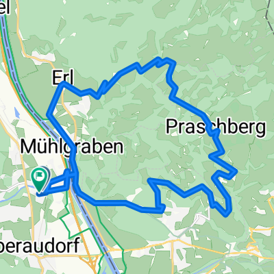 Praschbergrunde
- Distance
- 20.1 km
- Ascent
- 672 m
- Descent
- 669 m
- Location
- Oberaudorf, Bavaria, Germany
Open it in the app