
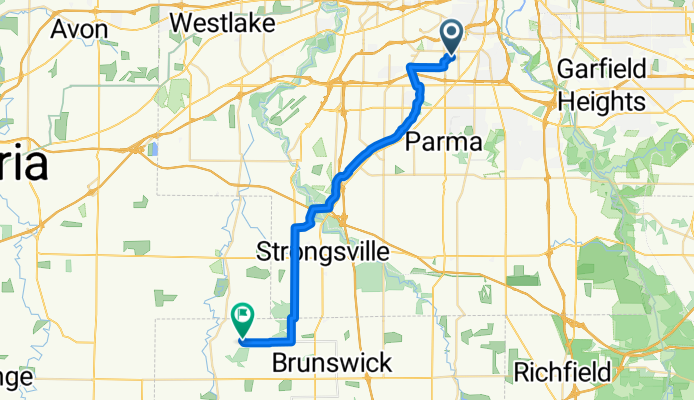
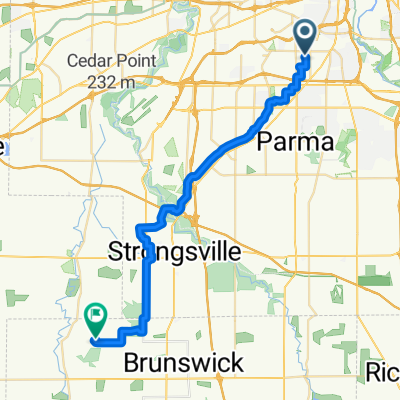
W 61st St, Cleveland to Grafton Rd, Valley City
A cycling route starting in Brooklyn, Ohio, United States.
Overview
About this route
Embark on an invigorating 32.2 km cycling adventure through scenic landscapes, where gentle ascents of 127 meters and smooth descents of 94 meters add variety to your ride. The route peaks at an elevation of 310 meters, offering rewarding views and a sense of accomplishment. The path is predominantly paved, ensuring a smooth and enjoyable experience for all cyclists. Whether you're a seasoned rider or a casual cyclist, this route promises a delightful blend of challenge and scenery.
AI generated
- 1 h 32 min
- Duration
- 32.2 km
- Distance
- 128 m
- Ascent
- 94 m
- Descent
- 21 km/h
- Avg. speed
- 310 m
- Max. altitude
Route quality
Waytypes & surfaces along the route
Waytypes
Road
21.2 km
(66 %)
Cycleway
5.1 km
(16 %)
Surfaces
Paved
14.2 km
(44 %)
Asphalt
13.5 km
(42 %)
Paved (undefined)
0.6 km
(2 %)
Undefined
18 km
(56 %)
Continue with Bikemap
Use, edit, or download this cycling route
You would like to ride W 61st St, Cleveland to Grafton Rd, Valley City or customize it for your own trip? Here is what you can do with this Bikemap route:
Free features
- Save this route as favorite or in collections
- Copy & plan your own version of this route
- Sync your route with Garmin or Wahoo
Premium features
Free trial for 3 days, or one-time payment. More about Bikemap Premium.
- Navigate this route on iOS & Android
- Export a GPX / KML file of this route
- Create your custom printout (try it for free)
- Download this route for offline navigation
Discover more Premium features.
Get Bikemap PremiumFrom our community
Other popular routes starting in Brooklyn
 41.436, -81.729 to 41.261, -81.900
- Distance
- 33.6 km
- Ascent
- 270 m
- Descent
- 310 m
- Location
- Brooklyn, Ohio, United States
 Wildlife Way 3900, Cleveland to North Saint James Parkway 2170, Cleveland Heights
- Distance
- 20.7 km
- Ascent
- 202 m
- Descent
- 119 m
- Location
- Brooklyn, Ohio, United States
 Wildlife Way 3900, Cleveland to North Saint James Parkway 2176, Cleveland Heights
- Distance
- 20.7 km
- Ascent
- 202 m
- Descent
- 119 m
- Location
- Brooklyn, Ohio, United States
 7901 Lawn Ave, Cleveland to 7813 Lawn Ave, Cleveland
- Distance
- 8.5 km
- Ascent
- 42 m
- Descent
- 41 m
- Location
- Brooklyn, Ohio, United States
 Wildlife Way 3700, Cleveland to Wilson Mills Road 6151, Highland Heights
- Distance
- 53.4 km
- Ascent
- 477 m
- Descent
- 346 m
- Location
- Brooklyn, Ohio, United States
 Brookpark-Seneca
- Distance
- 29.4 km
- Ascent
- 233 m
- Descent
- 85 m
- Location
- Brooklyn, Ohio, United States
 savers
- Distance
- 3.7 km
- Ascent
- 70 m
- Descent
- 60 m
- Location
- Brooklyn, Ohio, United States
 3000–3098 W 50th Pl, Cleveland to 36080 Chester Rd, Avon
- Distance
- 30.6 km
- Ascent
- 20 m
- Descent
- 30 m
- Location
- Brooklyn, Ohio, United States
Open it in the app