
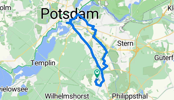
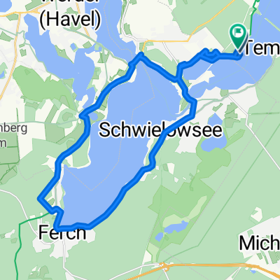
Philippsthaler Weg nach Saarmunder Weg
A cycling route starting in Michendorf, Brandenburg, Germany.
Overview
About this route
- 2 h
- Duration
- 20.3 km
- Distance
- 574 m
- Ascent
- 595 m
- Descent
- 10.1 km/h
- Avg. speed
- 99 m
- Max. altitude

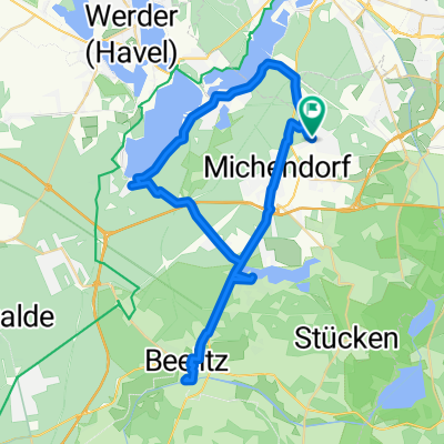
Route quality
Waytypes & surfaces along the route
Waytypes
Path
9.3 km
(46 %)
Quiet road
3 km
(15 %)
Surfaces
Paved
10.5 km
(52 %)
Unpaved
4.9 km
(24 %)
Asphalt
8.7 km
(43 %)
Gravel
3.6 km
(18 %)
Continue with Bikemap
Use, edit, or download this cycling route
You would like to ride Philippsthaler Weg nach Saarmunder Weg or customize it for your own trip? Here is what you can do with this Bikemap route:
Free features
- Save this route as favorite or in collections
- Copy & plan your own version of this route
- Sync your route with Garmin or Wahoo
Premium features
Free trial for 3 days, or one-time payment. More about Bikemap Premium.
- Navigate this route on iOS & Android
- Export a GPX / KML file of this route
- Create your custom printout (try it for free)
- Download this route for offline navigation
Discover more Premium features.
Get Bikemap PremiumFrom our community
Other popular routes starting in Michendorf
 De Straße Ohne Straßennamen a Koblenzer Straße
- Distance
- 35.3 km
- Ascent
- 152 m
- Descent
- 179 m
- Location
- Michendorf, Brandenburg, Germany
 Hubertusweg 53A nach An der Aue
- Distance
- 45.8 km
- Ascent
- 251 m
- Descent
- 251 m
- Location
- Michendorf, Brandenburg, Germany
 Friedensradfahrt 2009 Paris - Moskau 19. Etappe Caputh - Berlin am 24. Juli 2009
- Distance
- 44.5 km
- Ascent
- 224 m
- Descent
- 220 m
- Location
- Michendorf, Brandenburg, Germany
 Potsdamer Haveltour 1 CLONED FROM ROUTE 196024
- Distance
- 30.6 km
- Ascent
- 73 m
- Descent
- 70 m
- Location
- Michendorf, Brandenburg, Germany
 Am Bahnhof, Michendorf nach Dorfstraße, Tauche
- Distance
- 109 km
- Ascent
- 402 m
- Descent
- 407 m
- Location
- Michendorf, Brandenburg, Germany
 Michendorf - Friedrichshain
- Distance
- 42.4 km
- Ascent
- 4 m
- Descent
- 4 m
- Location
- Michendorf, Brandenburg, Germany
 An der Pirschheide nach An der Pirschheide
- Distance
- 21.1 km
- Ascent
- 130 m
- Descent
- 130 m
- Location
- Michendorf, Brandenburg, Germany
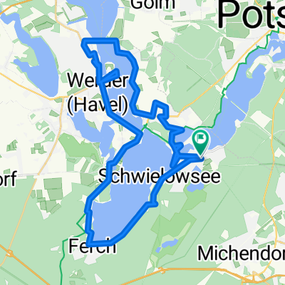 Haveltour
- Distance
- 42.6 km
- Ascent
- 131 m
- Descent
- 130 m
- Location
- Michendorf, Brandenburg, Germany
Open it in the app