

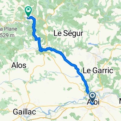
Albi to Montauban
A cycling route starting in Albi, Occitanie, France.
Overview
About this route
With the exception of the kilometers on D988 west toward Gaillac and and D18 which circles Gaillac on the north, all riding was on zero and low-traffic roads. D92 was a great way to avoid traffice getting into Montauban. And of course D13 is a great low-traffic way to depart from Albi to the west.
We highly recommend this ride. Reasonably challenging and scenic for the most part.
- 5 h 37 min
- Duration
- 75.4 km
- Distance
- 968 m
- Ascent
- 1,022 m
- Descent
- 13.4 km/h
- Avg. speed
- 287 m
- Max. altitude

Route photos


Route quality
Waytypes & surfaces along the route
Waytypes
Road
49.8 km
(66 %)
Quiet road
8.3 km
(11 %)
Surfaces
Paved
28.7 km
(38 %)
Asphalt
28.7 km
(38 %)
Undefined
46.8 km
(62 %)
Continue with Bikemap
Use, edit, or download this cycling route
You would like to ride Albi to Montauban or customize it for your own trip? Here is what you can do with this Bikemap route:
Free features
- Save this route as favorite or in collections
- Copy & plan your own version of this route
- Sync your route with Garmin or Wahoo
Premium features
Free trial for 3 days, or one-time payment. More about Bikemap Premium.
- Navigate this route on iOS & Android
- Export a GPX / KML file of this route
- Create your custom printout (try it for free)
- Download this route for offline navigation
Discover more Premium features.
Get Bikemap PremiumFrom our community
Other popular routes starting in Albi
 2014 Ride Day 103 - Albi to Montauban
- Distance
- 74.1 km
- Ascent
- 387 m
- Descent
- 439 m
- Location
- Albi, Occitanie, France
 **17-X. Albi - Saint Flour (197,5 Km)
- Distance
- 197.3 km
- Ascent
- 3,336 m
- Descent
- 2,707 m
- Location
- Albi, Occitanie, France
 2012 French Tour -- Ride Day 58 -- 23 October 2012 -- Albi -- Circle
- Distance
- 100.3 km
- Ascent
- 997 m
- Descent
- 999 m
- Location
- Albi, Occitanie, France
 2012 French Tour -- Ride Day 60 -- 28 October 2012 -- Albi to Blagnac (Toulouse)
- Distance
- 97 km
- Ascent
- 243 m
- Descent
- 268 m
- Location
- Albi, Occitanie, France
 2012 French Tour -- Ride Day 59 -- 25 October 2012 -- Albi -- Circle
- Distance
- 54.3 km
- Ascent
- 622 m
- Descent
- 622 m
- Location
- Albi, Occitanie, France
 4. Albi - Brousse-le-Chateau
- Distance
- 70.3 km
- Ascent
- 904 m
- Descent
- 829 m
- Location
- Albi, Occitanie, France
 Rue de l'Ort en Salvy nach D9
- Distance
- 43.1 km
- Ascent
- 743 m
- Descent
- 777 m
- Location
- Albi, Occitanie, France
 Open Tour. Etapa 1. Albi > Toulouse
- Distance
- 145.5 km
- Ascent
- 1,081 m
- Descent
- 1,109 m
- Location
- Albi, Occitanie, France
Open it in the app