
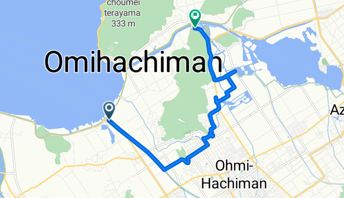
Day 1 - Scenic spot 1
A cycling route starting in Ōmihachiman, Shiga Prefecture, Japan.
Overview
About this route
- 34 min
- Duration
- 9.4 km
- Distance
- 55 m
- Ascent
- 50 m
- Descent
- 16.5 km/h
- Avg. speed
- 106 m
- Max. altitude
Route quality
Waytypes & surfaces along the route
Waytypes
Cycleway
4.2 km
(45 %)
Quiet road
3.6 km
(38 %)
Surfaces
Paved
5.8 km
(62 %)
Asphalt
4.6 km
(49 %)
Paved (undefined)
1.2 km
(13 %)
Undefined
3.6 km
(38 %)
Continue with Bikemap
Use, edit, or download this cycling route
You would like to ride Day 1 - Scenic spot 1 or customize it for your own trip? Here is what you can do with this Bikemap route:
Free features
- Save this route as favorite or in collections
- Copy & plan your own version of this route
- Sync your route with Garmin or Wahoo
Premium features
Free trial for 3 days, or one-time payment. More about Bikemap Premium.
- Navigate this route on iOS & Android
- Export a GPX / KML file of this route
- Create your custom printout (try it for free)
- Download this route for offline navigation
Discover more Premium features.
Get Bikemap PremiumFrom our community
Other popular routes starting in Ōmihachiman
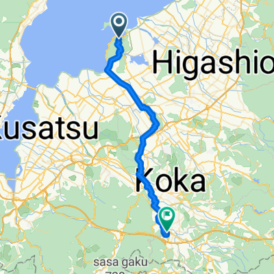 Kyukamura to Koka
- Distance
- 42.4 km
- Ascent
- 375 m
- Descent
- 293 m
- Location
- Ōmihachiman, Shiga Prefecture, Japan
 Nirasaki 2
- Distance
- 439.8 km
- Ascent
- 669 m
- Descent
- 392 m
- Location
- Ōmihachiman, Shiga Prefecture, Japan
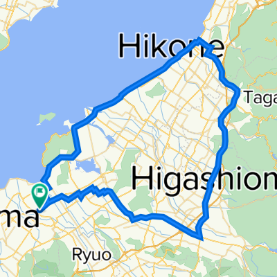
 近江八幡サイクリング
- Distance
- 29.5 km
- Ascent
- 84 m
- Descent
- 85 m
- Location
- Ōmihachiman, Shiga Prefecture, Japan
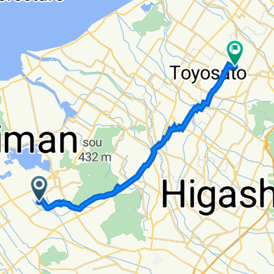
 長田町, 近江八幡市 to 尼子1422, 犬上郡甲良町
- Distance
- 17.5 km
- Ascent
- 35 m
- Descent
- 25 m
- Location
- Ōmihachiman, Shiga Prefecture, Japan
 J2 Omihachiman-Moriyama-Kyoto-Kobe
- Distance
- 124.4 km
- Ascent
- 166 m
- Descent
- 228 m
- Location
- Ōmihachiman, Shiga Prefecture, Japan
 江頭町674-3, 近江八幡市 to 江頭町608-2, 近江八幡市
- Distance
- 78.6 km
- Ascent
- 287 m
- Descent
- 291 m
- Location
- Ōmihachiman, Shiga Prefecture, Japan
 県道199号, 近江八幡市 to 尼子1477, 犬上郡甲良町
- Distance
- 18 km
- Ascent
- 71 m
- Descent
- 50 m
- Location
- Ōmihachiman, Shiga Prefecture, Japan
 Spred Out Afternoon Track In Omihachiman
- Distance
- 14.6 km
- Ascent
- 40 m
- Descent
- 42 m
- Location
- Ōmihachiman, Shiga Prefecture, Japan
Open it in the app