
Von Wien bis Hallstatt
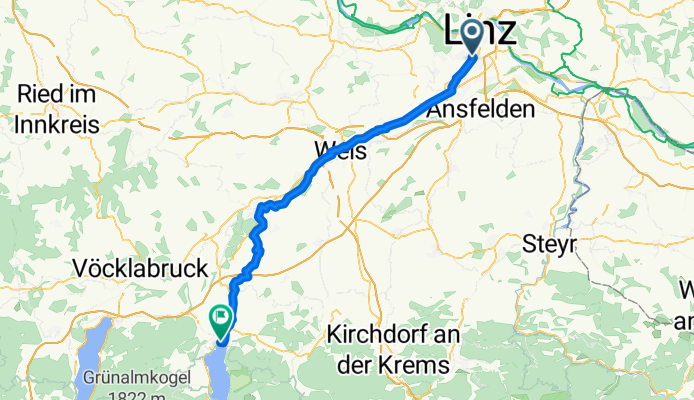
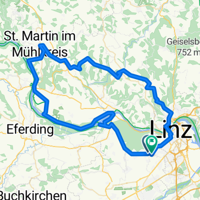
Leonding - Gmunden
A cycling route starting in Leonding, Upper Austria, Austria.
Overview
About this route
- 4 h 5 min
- Duration
- 68.9 km
- Distance
- 445 m
- Ascent
- 292 m
- Descent
- 16.9 km/h
- Avg. speed
- 498 m
- Max. altitude
Part of
Von Wien bis Hallstatt
5 stages
Route quality
Waytypes & surfaces along the route
Waytypes
Quiet road
35.8 km
(52 %)
Path
22.7 km
(33 %)
Surfaces
Paved
35.8 km
(52 %)
Unpaved
0.7 km
(1 %)
Asphalt
34.4 km
(50 %)
Paved (undefined)
1.4 km
(2 %)
Continue with Bikemap
Use, edit, or download this cycling route
You would like to ride Leonding - Gmunden or customize it for your own trip? Here is what you can do with this Bikemap route:
Free features
- Save this route as favorite or in collections
- Copy & plan your own version of this route
- Sync your route with Garmin or Wahoo
Premium features
Free trial for 3 days, or one-time payment. More about Bikemap Premium.
- Navigate this route on iOS & Android
- Export a GPX / KML file of this route
- Create your custom printout (try it for free)
- Download this route for offline navigation
Discover more Premium features.
Get Bikemap PremiumFrom our community
Other popular routes starting in Leonding
 Albert-Schöpf-Straße, Linz nach Heideweg, Engerwitzdorf
- Distance
- 18.2 km
- Ascent
- 258 m
- Descent
- 149 m
- Location
- Leonding, Upper Austria, Austria
 Albert-Schöpf-Straße, Linz nach Albert-Schöpf-Straße, Linz
- Distance
- 35.1 km
- Ascent
- 642 m
- Descent
- 642 m
- Location
- Leonding, Upper Austria, Austria
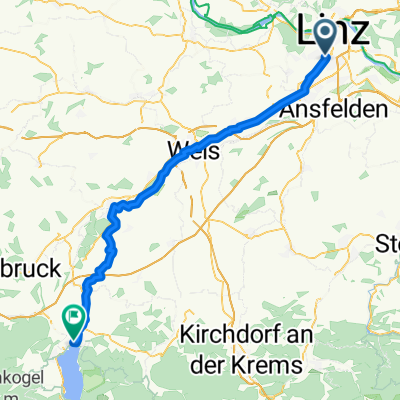 Leonding - Gmunden
- Distance
- 68.9 km
- Ascent
- 445 m
- Descent
- 292 m
- Location
- Leonding, Upper Austria, Austria
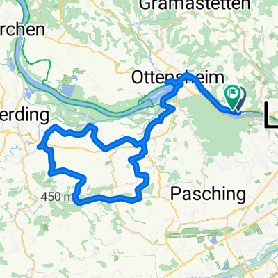
 Linz / Ottensheim / Rufling / Linz
- Distance
- 42.7 km
- Ascent
- 225 m
- Descent
- 224 m
- Location
- Leonding, Upper Austria, Austria
 R 18 Eferdinger Radweg
- Distance
- 55.5 km
- Ascent
- 344 m
- Descent
- 342 m
- Location
- Leonding, Upper Austria, Austria
 Route in Leonding
- Distance
- 78.7 km
- Ascent
- 1,368 m
- Descent
- 1,376 m
- Location
- Leonding, Upper Austria, Austria
 Leonding-Rufling-Scharten und retour
- Distance
- 51.1 km
- Ascent
- 608 m
- Descent
- 607 m
- Location
- Leonding, Upper Austria, Austria
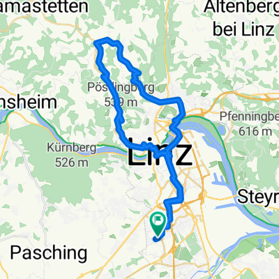
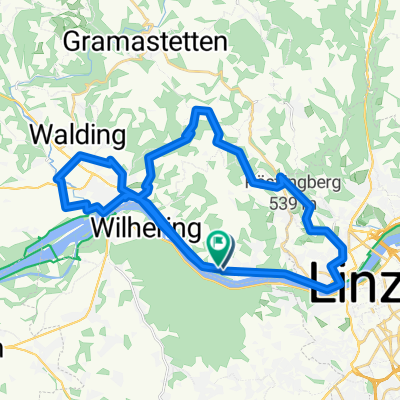 Walding - Pöstlingberg - Urfahr - Donauradweg - Walding
- Distance
- 41.8 km
- Ascent
- 683 m
- Descent
- 676 m
- Location
- Leonding, Upper Austria, Austria
Open it in the app