
南六郷3丁目, 大田区へ南六郷3丁目, 大田区
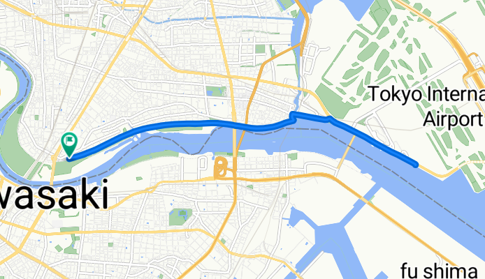
A cycling route starting in Kawasaki, Kanagawa, Japan.
Overview
About this route
Discover the Scenic Ride!
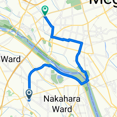
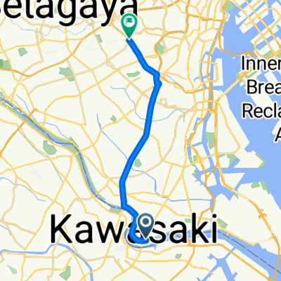
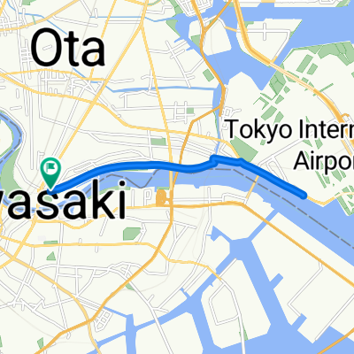
Embark on a delightful cycling adventure along this picturesque route, perfect for both beginners and seasoned riders alike. Covering a total distance of 12.7 kilometers, this route offers a gentle challenge with a modest ascent of 40 meters and a smooth descent of 42 meters.
As you pedal along, enjoy the serene surroundings and take in the breathtaking views. The route's elevation varies slightly, reaching a maximum height of 13 meters, providing just the right amount of thrill.
Whether you're looking for a leisurely ride or a bit of a workout, this route promises an enjoyable experience for everyone. So grab your bike, hit the road, and explore the beauty of this scenic path!
AI generated
- 103 h 57 min
- Duration
- 12.7 km
- Distance
- 40 m
- Ascent
- 42 m
- Descent
- 0.1 km/h
- Avg. speed
- 13 m
- Max. altitude

Route quality
Waytypes & surfaces along the route
Waytypes
Cycleway
8.5 km
(67 %)
Pedestrian area
2.2 km
(17 %)
Surfaces
Paved
5.7 km
(45 %)
Asphalt
4.2 km
(33 %)
Paved (undefined)
1.5 km
(12 %)
Undefined
7 km
(55 %)
Continue with Bikemap
Use, edit, or download this cycling route
You would like to ride 南六郷3丁目, 大田区へ南六郷3丁目, 大田区 or customize it for your own trip? Here is what you can do with this Bikemap route:
Free features
- Save this route as favorite or in collections
- Copy & plan your own version of this route
- Sync your route with Garmin or Wahoo
Premium features
Free trial for 3 days, or one-time payment. More about Bikemap Premium.
- Navigate this route on iOS & Android
- Export a GPX / KML file of this route
- Create your custom printout (try it for free)
- Download this route for offline navigation
Discover more Premium features.
Get Bikemap PremiumFrom our community
Other popular routes starting in Kawasaki
 南六郷3丁目, 大田区へ南六郷3丁目, 大田区
- Distance
- 10.5 km
- Ascent
- 30 m
- Descent
- 34 m
- Location
- Kawasaki, Kanagawa, Japan
 南六郷3丁目, 大田区へ南六郷3丁目, 大田区
- Distance
- 10.4 km
- Ascent
- 35 m
- Descent
- 37 m
- Location
- Kawasaki, Kanagawa, Japan
 南六郷3丁目, 大田区へ上目黒1丁目, 目黒区
- Distance
- 15.8 km
- Ascent
- 116 m
- Descent
- 102 m
- Location
- Kawasaki, Kanagawa, Japan
 鶴見川源流の泉
- Distance
- 35.8 km
- Ascent
- 200 m
- Descent
- 171 m
- Location
- Kawasaki, Kanagawa, Japan
 5丁目 まで4丁目
- Distance
- 11.9 km
- Ascent
- 71 m
- Descent
- 85 m
- Location
- Kawasaki, Kanagawa, Japan
 川崎市高津区 近隣
- Distance
- 11.6 km
- Ascent
- 87 m
- Descent
- 117 m
- Location
- Kawasaki, Kanagawa, Japan
 南六郷3丁目, 大田区へ上目黒3丁目, 目黒区
- Distance
- 14.3 km
- Ascent
- 65 m
- Descent
- 61 m
- Location
- Kawasaki, Kanagawa, Japan
 南六郷3丁目, 大田区へ南六郷3丁目, 大田区
- Distance
- 12.7 km
- Ascent
- 40 m
- Descent
- 42 m
- Location
- Kawasaki, Kanagawa, Japan
Open it in the app