

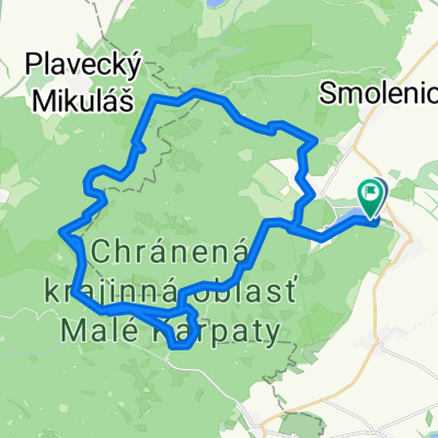
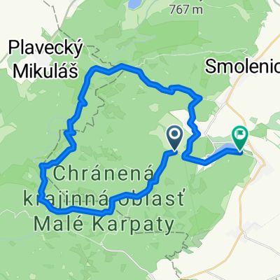
Katarinka okruh z Parkoviska
A cycling route starting in Smolenice, Trnava Region, Slovakia.
Overview
About this route
Discover the thrill of cycling along this scenic 31.2 km route, perfect for adventure seekers. The journey begins at a manageable 394 meters, gradually ascending to a peak elevation of 394 meters, offering breathtaking views along the way. Prepare for a mix of terrains—paved paths and sections with a touch of gravel—that will keep your ride dynamic and engaging. With an ascent of 651 meters and a descent of 649 meters, this route promises a well-rounded challenge. Whether you're a seasoned cyclist or just looking for a new adventure, this route is sure to provide an exhilarating experience. Enjoy the ride!
AI generated
- 3 h 25 min
- Duration
- 31.2 km
- Distance
- 651 m
- Ascent
- 650 m
- Descent
- 9.1 km/h
- Avg. speed
- 395 m
- Max. altitude

Route quality
Waytypes & surfaces along the route
Waytypes
Track
25.9 km
(83 %)
Access road
4.1 km
(13 %)
Surfaces
Paved
8.4 km
(27 %)
Unpaved
21.2 km
(68 %)
Gravel
12.5 km
(40 %)
Asphalt
8.1 km
(26 %)
Continue with Bikemap
Use, edit, or download this cycling route
You would like to ride Katarinka okruh z Parkoviska or customize it for your own trip? Here is what you can do with this Bikemap route:
Free features
- Save this route as favorite or in collections
- Copy & plan your own version of this route
- Sync your route with Garmin or Wahoo
Premium features
Free trial for 3 days, or one-time payment. More about Bikemap Premium.
- Navigate this route on iOS & Android
- Export a GPX / KML file of this route
- Create your custom printout (try it for free)
- Download this route for offline navigation
Discover more Premium features.
Get Bikemap PremiumFrom our community
Other popular routes starting in Smolenice
 Malé Karpaty - Vápenná, Klokoč, Báborská,
- Distance
- 13.8 km
- Ascent
- 609 m
- Descent
- 609 m
- Location
- Smolenice, Trnava Region, Slovakia
 Katarinka okruh z Parkoviska
- Distance
- 31.2 km
- Ascent
- 651 m
- Descent
- 650 m
- Location
- Smolenice, Trnava Region, Slovakia
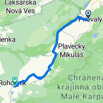 Prievaly do Slovensko
- Distance
- 23.6 km
- Ascent
- 74 m
- Descent
- 108 m
- Location
- Smolenice, Trnava Region, Slovakia
 malé karpaty
- Distance
- 48.7 km
- Ascent
- 1,502 m
- Descent
- 1,493 m
- Location
- Smolenice, Trnava Region, Slovakia
 mon repos
- Distance
- 39.5 km
- Ascent
- 1,159 m
- Descent
- 1,159 m
- Location
- Smolenice, Trnava Region, Slovakia
 Lošonec do Nivy
- Distance
- 29.5 km
- Ascent
- 820 m
- Descent
- 851 m
- Location
- Smolenice, Trnava Region, Slovakia
 Boleraz Bohdanovce(Dolna Krupa)
- Distance
- 29.2 km
- Ascent
- 181 m
- Descent
- 184 m
- Location
- Smolenice, Trnava Region, Slovakia
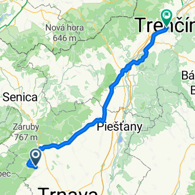 Horné Orešany, Horné Orešany až Štúrovo nám, Trenčín
- Distance
- 92.3 km
- Ascent
- 902 m
- Descent
- 889 m
- Location
- Smolenice, Trnava Region, Slovakia
Open it in the app