
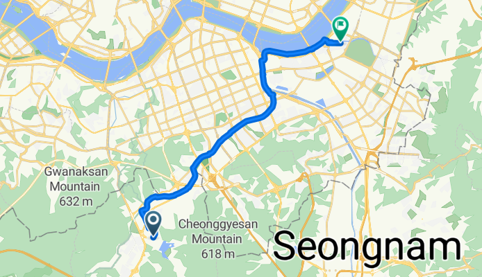
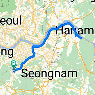
막계동, 과천시에서 신천동, 서울특별시까지
A cycling route starting in Anyang-si, Gyeonggi-do, South Korea.
Overview
About this route
Discover the thrill of cycling on this scenic route, perfect for all levels of riders! Starting at a comfortable low elevation, you'll enjoy a gentle ascent of 45 meters, followed by a thrilling descent of 68 meters. The ride peaks at a maximum elevation of 52 meters, offering stunning views along the way.
This route is ideal for those seeking a mix of challenge and beauty, with a total distance of 18.9 kilometers. Whether you're cruising on paved paths or enjoying the thrill of unpaved stretches, this ride promises an exhilarating experience. Get ready to pedal through diverse landscapes and embrace the joy of cycling!
AI generated
- 2 h 59 min
- Duration
- 18.9 km
- Distance
- 46 m
- Ascent
- 69 m
- Descent
- 6.4 km/h
- Avg. speed
- 52 m
- Max. altitude

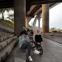
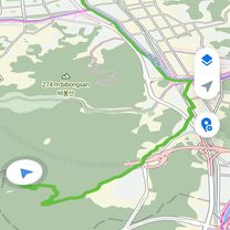
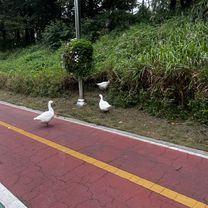
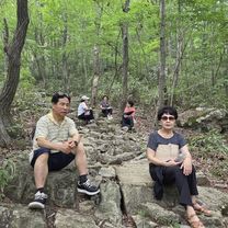
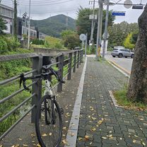
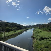
Route photos


Continue with Bikemap
Use, edit, or download this cycling route
You would like to ride 막계동, 과천시에서 신천동, 서울특별시까지 or customize it for your own trip? Here is what you can do with this Bikemap route:
Free features
- Save this route as favorite or in collections
- Copy & plan your own version of this route
- Sync your route with Garmin or Wahoo
Premium features
Free trial for 3 days, or one-time payment. More about Bikemap Premium.
- Navigate this route on iOS & Android
- Export a GPX / KML file of this route
- Create your custom printout (try it for free)
- Download this route for offline navigation
Discover more Premium features.
Get Bikemap PremiumFrom our community
Other popular routes starting in Anyang-si
 막계동, 과천시에서 신천동, 서울특별시까지
- Distance
- 18.9 km
- Ascent
- 46 m
- Descent
- 69 m
- Location
- Anyang-si, Gyeonggi-do, South Korea
 SKV1에서 삼막사 까지
- Distance
- 11.9 km
- Ascent
- 346 m
- Descent
- 77 m
- Location
- Anyang-si, Gyeonggi-do, South Korea
 과천동, 과천시에서 양지마을1로, 과천시까지
- Distance
- 27.1 km
- Ascent
- 147 m
- Descent
- 140 m
- Location
- Anyang-si, Gyeonggi-do, South Korea
![관양동 1443-2Ph0]으로 라우팅](https://media.bikemap.net/routes/17594541/gallery/thumbs/2ff09bfe-a75c-43bb-8e36-c04f88361a87.jpg.208x208_q80_crop.jpg) 관양동 1443-2Ph0]으로 라우팅
관양동 1443-2Ph0]으로 라우팅- Distance
- 14.1 km
- Ascent
- 88 m
- Descent
- 106 m
- Location
- Anyang-si, Gyeonggi-do, South Korea
 안정적인 라이딩
- Distance
- 47 km
- Ascent
- 215 m
- Descent
- 221 m
- Location
- Anyang-si, Gyeonggi-do, South Korea
 선바위 - 팔당대교
- Distance
- 72 km
- Ascent
- 492 m
- Descent
- 496 m
- Location
- Anyang-si, Gyeonggi-do, South Korea
 평촌동 61-1 ~ 평촌동 66-18
- Distance
- 86.4 km
- Ascent
- 377 m
- Descent
- 381 m
- Location
- Anyang-si, Gyeonggi-do, South Korea
 안양8동 산162-5 ~ 안양동 349-44
- Distance
- 24.3 km
- Ascent
- 112 m
- Descent
- 134 m
- Location
- Anyang-si, Gyeonggi-do, South Korea
Open it in the app