

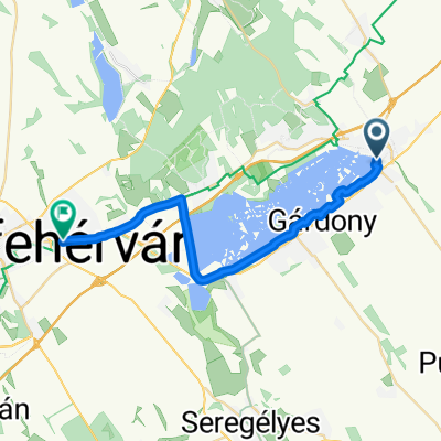
Velencei tó 2025.11.01. új bringa
A cycling route starting in Velence, Fejér, Hungary.
Overview
About this route
- 1 h 39 min
- Duration
- 29.4 km
- Distance
- 74 m
- Ascent
- 121 m
- Descent
- 17.9 km/h
- Avg. speed
- 150 m
- Max. altitude

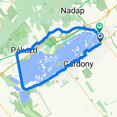
Route quality
Waytypes & surfaces along the route
Waytypes
Cycleway
15 km
(51 %)
Quiet road
7.1 km
(24 %)
Surfaces
Paved
23.8 km
(81 %)
Asphalt
23.2 km
(79 %)
Paved (undefined)
0.6 km
(2 %)
Undefined
5.6 km
(19 %)
Continue with Bikemap
Use, edit, or download this cycling route
You would like to ride Velencei tó 2025.11.01. új bringa or customize it for your own trip? Here is what you can do with this Bikemap route:
Free features
- Save this route as favorite or in collections
- Copy & plan your own version of this route
- Sync your route with Garmin or Wahoo
Premium features
Free trial for 3 days, or one-time payment. More about Bikemap Premium.
- Navigate this route on iOS & Android
- Export a GPX / KML file of this route
- Create your custom printout (try it for free)
- Download this route for offline navigation
Discover more Premium features.
Get Bikemap PremiumFrom our community
Other popular routes starting in Velence
 Radnóti utca, Velence - Radnóti utca, Velence
- Distance
- 31.7 km
- Ascent
- 231 m
- Descent
- 236 m
- Location
- Velence, Fejér, Hungary
 Tópart utca, Velence - Budai út, Székesfehérvár
- Distance
- 23.9 km
- Ascent
- 89 m
- Descent
- 54 m
- Location
- Velence, Fejér, Hungary
 Enyedi utca, Velence - Enyedi utca, Velence
- Distance
- 57.9 km
- Ascent
- 170 m
- Descent
- 169 m
- Location
- Velence, Fejér, Hungary
 Velence - Dolovai sor, Székesfehérvár
- Distance
- 23.9 km
- Ascent
- 84 m
- Descent
- 48 m
- Location
- Velence, Fejér, Hungary
 Velence - Dolovai sor, Székesfehérvár
- Distance
- 23.9 km
- Ascent
- 69 m
- Descent
- 34 m
- Location
- Velence, Fejér, Hungary
 Tél utca - Tél utca
- Distance
- 32.1 km
- Ascent
- 492 m
- Descent
- 536 m
- Location
- Velence, Fejér, Hungary
 Velence Béke utca - Velence Tó utca
- Distance
- 28.4 km
- Ascent
- 127 m
- Descent
- 175 m
- Location
- Velence, Fejér, Hungary
 Panoráma út - Evezős út
- Distance
- 32.8 km
- Ascent
- 63 m
- Descent
- 134 m
- Location
- Velence, Fejér, Hungary
Open it in the app