

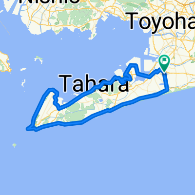
Overview
About this route
- 5 h 20 min
- Duration
- 92.7 km
- Distance
- 533 m
- Ascent
- 527 m
- Descent
- 17.4 km/h
- Avg. speed
- 58 m
- Max. altitude
Part of
Tokyo - Onimichi
13 stages
Route quality
Waytypes & surfaces along the route
Waytypes
Quiet road
58.4 km
(63 %)
Cycleway
21.3 km
(23 %)
Surfaces
Paved
7.4 km
(8 %)
Asphalt
6.5 km
(7 %)
Paved (undefined)
0.9 km
(1 %)
Undefined
85.2 km
(92 %)
Continue with Bikemap
Use, edit, or download this cycling route
You would like to ride Okazaki - Hamamatsu or customize it for your own trip? Here is what you can do with this Bikemap route:
Free features
- Save this route as favorite or in collections
- Copy & plan your own version of this route
- Split it into stages to create a multi-day tour
- Sync your route with Garmin or Wahoo
Premium features
Free trial for 3 days, or one-time payment. More about Bikemap Premium.
- Navigate this route on iOS & Android
- Export a GPX / KML file of this route
- Create your custom printout (try it for free)
- Download this route for offline navigation
Discover more Premium features.
Get Bikemap PremiumFrom our community
Other popular routes starting in Toyohashi
 toyohasi-okadaya
- Distance
- 17.8 km
- Ascent
- 18 m
- Descent
- 28 m
- Location
- Toyohashi, Aichi, Japan
 Moderate route in Toyohashi-Shi
- Distance
- 48.6 km
- Ascent
- 1,028 m
- Descent
- 1,024 m
- Location
- Toyohashi, Aichi, Japan
 豊橋市〜大垣市
- Distance
- 110.7 km
- Ascent
- 509 m
- Descent
- 514 m
- Location
- Toyohashi, Aichi, Japan
 豊橋〜岐阜
豊橋〜岐阜- Distance
- 104.2 km
- Ascent
- 338 m
- Descent
- 365 m
- Location
- Toyohashi, Aichi, Japan
 豊橋市 to ヒヨイタ, 新城市
- Distance
- 29.8 km
- Ascent
- 442 m
- Descent
- 333 m
- Location
- Toyohashi, Aichi, Japan
 大清水 まで大清水
- Distance
- 97.5 km
- Ascent
- 678 m
- Descent
- 642 m
- Location
- Toyohashi, Aichi, Japan
 竹島水族館行き
- Distance
- 18 km
- Ascent
- 145 m
- Descent
- 146 m
- Location
- Toyohashi, Aichi, Japan
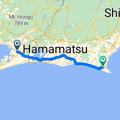 Okazaki - Hamamatsu
- Distance
- 92.7 km
- Ascent
- 533 m
- Descent
- 527 m
- Location
- Toyohashi, Aichi, Japan
Open it in the app