

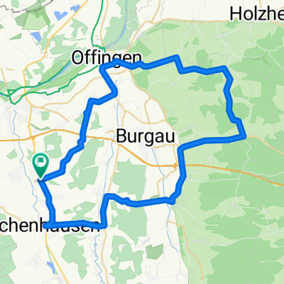
Hörlis - Halden
A cycling route starting in Ichenhausen, Bavaria, Germany.
Overview
About this route
Zwischen Kirchhaslach und Breitenbrunn sehr schwer.
Sonst eher flach.
- -:--
- Duration
- 66.8 km
- Distance
- 314 m
- Ascent
- 314 m
- Descent
- ---
- Avg. speed
- ---
- Max. altitude
Route quality
Waytypes & surfaces along the route
Waytypes
Quiet road
33.3 km
(50 %)
Busy road
19.1 km
(29 %)
Surfaces
Paved
33.7 km
(50 %)
Unpaved
0.1 km
(<1 %)
Asphalt
31.3 km
(47 %)
Paved (undefined)
2.4 km
(4 %)
Continue with Bikemap
Use, edit, or download this cycling route
You would like to ride Hörlis - Halden or customize it for your own trip? Here is what you can do with this Bikemap route:
Free features
- Save this route as favorite or in collections
- Copy & plan your own version of this route
- Sync your route with Garmin or Wahoo
Premium features
Free trial for 3 days, or one-time payment. More about Bikemap Premium.
- Navigate this route on iOS & Android
- Export a GPX / KML file of this route
- Create your custom printout (try it for free)
- Download this route for offline navigation
Discover more Premium features.
Get Bikemap PremiumFrom our community
Other popular routes starting in Ichenhausen
 Breitenbrunn
- Distance
- 35.6 km
- Ascent
- 151 m
- Descent
- 82 m
- Location
- Ichenhausen, Bavaria, Germany
 Radltour Kammel und Günz, Ausgangspunkt Hochwang
- Distance
- 68 km
- Ascent
- 214 m
- Descent
- 213 m
- Location
- Ichenhausen, Bavaria, Germany
 Günztal-Runde
- Distance
- 96.9 km
- Ascent
- 398 m
- Descent
- 403 m
- Location
- Ichenhausen, Bavaria, Germany
 Waldkirch - Winterbach
- Distance
- 54.5 km
- Ascent
- 365 m
- Descent
- 365 m
- Location
- Ichenhausen, Bavaria, Germany
 Wiesenbach
- Distance
- 18.6 km
- Ascent
- 68 m
- Descent
- 70 m
- Location
- Ichenhausen, Bavaria, Germany
 Rothtal - Günz 01
- Distance
- 64.8 km
- Ascent
- 299 m
- Descent
- 299 m
- Location
- Ichenhausen, Bavaria, Germany
 Unterallgäu Märxle Bedernau
- Distance
- 73.5 km
- Ascent
- 317 m
- Descent
- 317 m
- Location
- Ichenhausen, Bavaria, Germany
 Hörlis - Halden
- Distance
- 66.8 km
- Ascent
- 314 m
- Descent
- 314 m
- Location
- Ichenhausen, Bavaria, Germany
Open it in the app